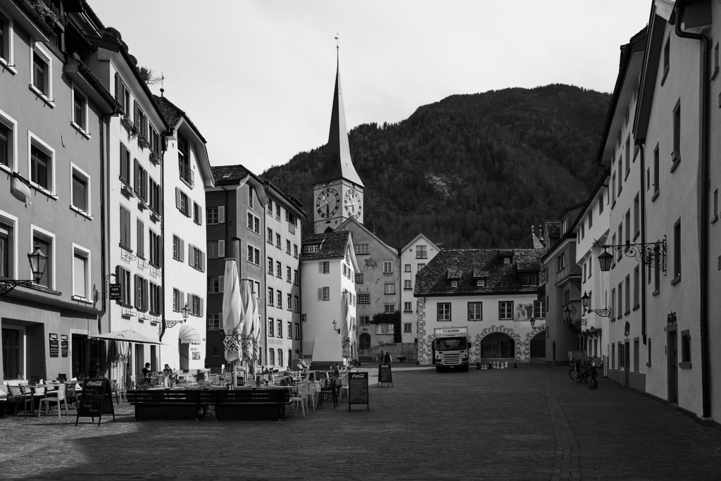
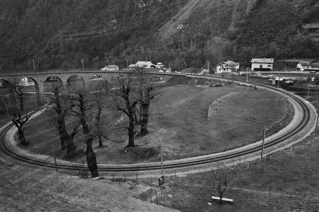
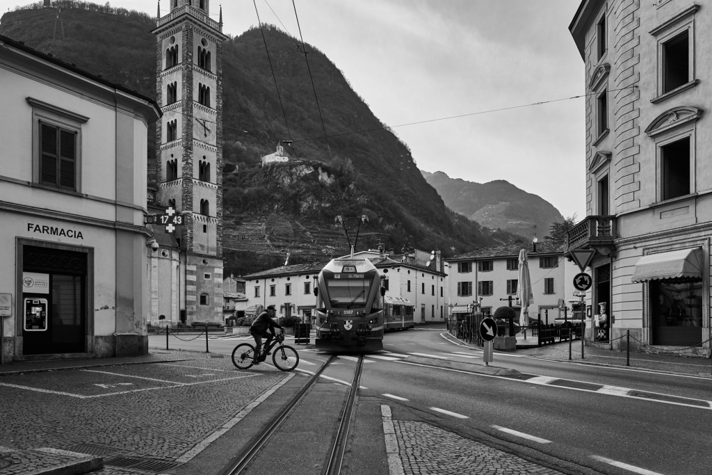
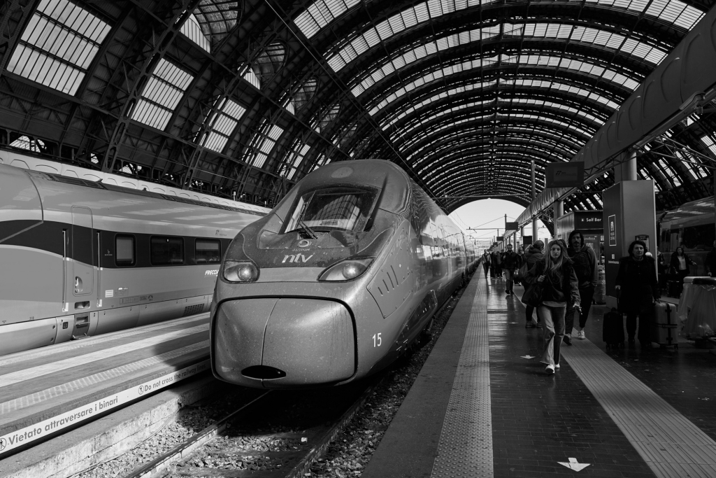
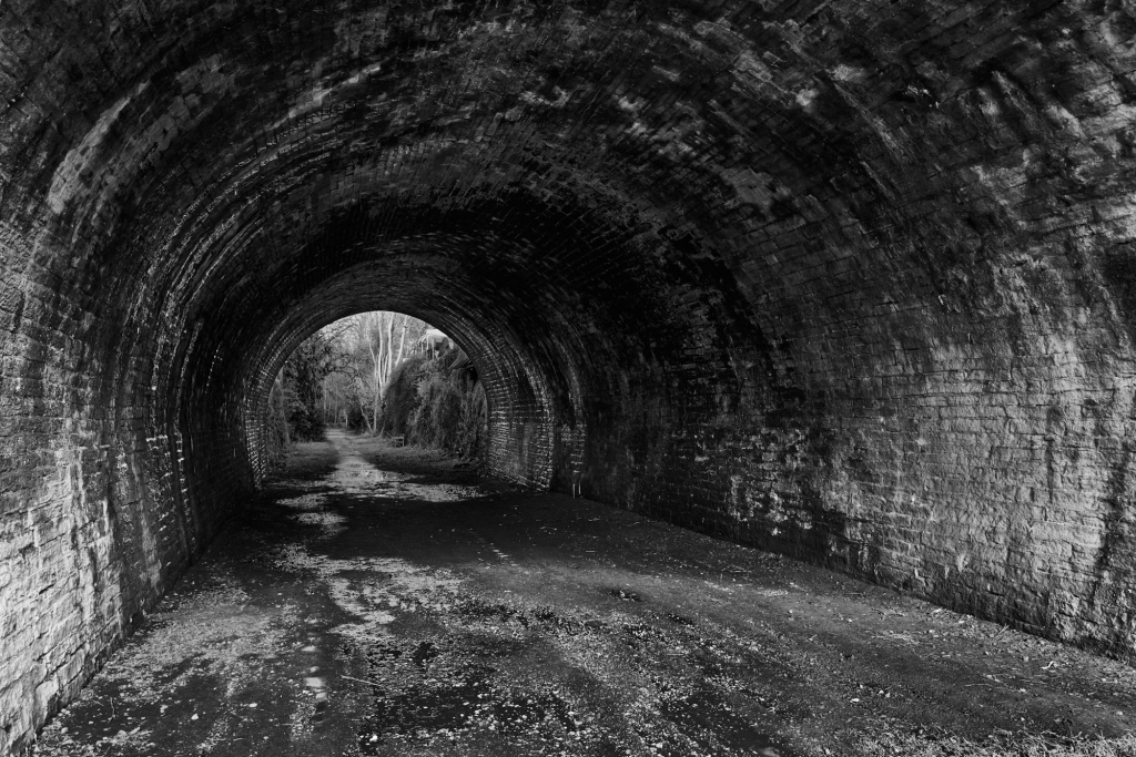
An interesting trip with a couple of hiccups. The primary purpose was to revisit Venice outside the tourist season, in March. Secondary targets were to travel over the Bernina Pass in winter, and to visit friends in Annecy on the way back. Usual start – East Midlands Railway to St Pancras, Eurostar to Paris – but there was a major signal failure and we arrived in London more than three hours late. A frantic dash to the Eurostar desk, and we were on the train fifteen minutes later! We arrived in Paris only an hour late. Next day, TGV from the Gare de Lyon to Zurich and a very quick transfer to the Chur train – no problem if you miss the train, as you don’t need to book on any Swiss train (apart from tourist trains like the Glacier Express). After a pleasant evening and morning in Chur, we took the Rhätische Bahn (RhB) to Tirano – the normal train, not the Bernina Express. Cheaper, fewer passengers, and a Photography Coach with a compartment lacking seats and having windows that lowered for photography. On the approach to Tirano the train runs along streets in places. The following day, train to Milano, which runs alongside Lake Como, to a flat next to the magnificent Milano Centrale station. From Milano it is a couple of hours to the modern station in Venice. See Venice by Night and Venice by Day for more pictures of Venice. We thought the return journey would be less complicated, but SNCF decided to go on strike – an occupational hazard travelling in France. The SNCF app did keep us updated. So a slow journey via Verona to Milano Centrale, enough time for lunch in the superb Mercado Centrale in the station, then SBB via the Simplon tunnel to Genève. The SNCF app said take a local train then a bus to Annecy. I enquired about this, and was told that there was a direct train in about 20 minutes! After a very enjoyable stay in Annecy, getting home was an easy but very long day – TGV to Paris via Chambéry, Number 91 bus from the Gare de Lyon to the Gare du Nord, Eurostar to London, East Midlands to Chesterfield, taxi home.
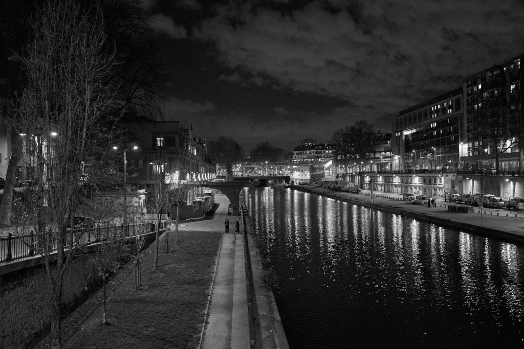
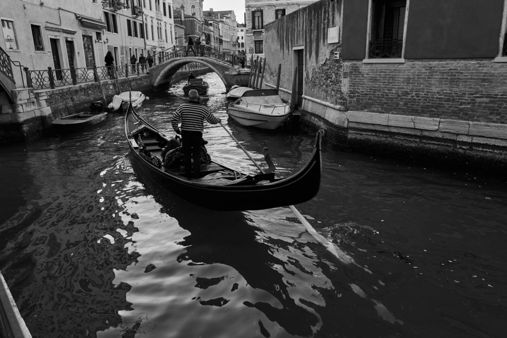
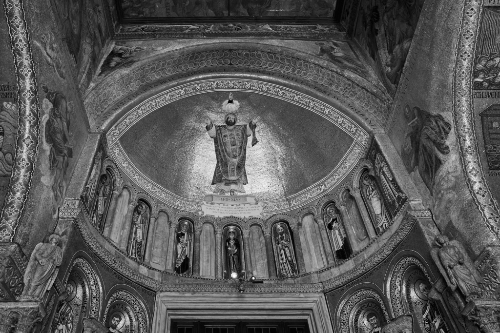
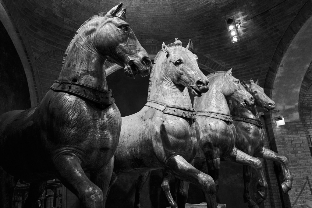
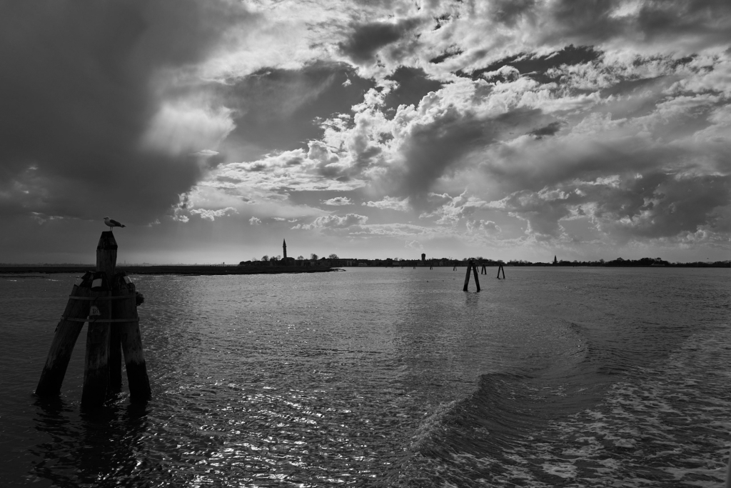
Canal St Martin, Paris.Martinsplatz and Martinskirche, Chur.Rhätische Bahn (RhB) between Chur and Samedan. The Landwasserviadukt and tunnel.Rhätische Bahn (RhB) between Pontresina and Tirano. The frozen Lago Bianco at the Bernina Pass.Rhätische Bahn (RhB) between Pontresina and Tirano, crossing the Bernina Pass. The spiral Kreisviadukt at Brusio.The train to St Moritz crossing the roundabout by Santuario Madonna di Tirano.The food market at Milano Centrale station.Milano Centrale station.View from the Duomo roof, Milan.The Duomo, Milan.Venice.Venice. Gondola parking at Sotoporto del Cavalletto, a few metres from Piazza San Marco.Venice, St Mark’s.The famous horses of St Mark’s – the originals, now inside the church, with replicas outside.Venice. Piazza San Marco from St Mark’s.Venice. Palazzo Ducale from St Mark’s.Venice Lagoon.Milano Cantrale station.Annecy.
The Cromford Canal, giving access to the Trent, was built by William Jessop and opened in 1792. The Peak Forest Canal from Manchester to Bugsworth and Whaley Bridge, engineered by Benjamin Outram, was opened in 1800. There was a proposal for a canal joining the two canals along the line of the C&HPR which was abandoned because of the lack of water at the highest level. Each boat passing up or down the locks removes a lockful of water from the summit level, and there is no source of water on the limestone plateau. A feasible route was surveyed by John Rennie. The route was up the Derwent Valley to Hope, then to the head of Edale and a tunnel nearly three miles long to Chapel Milton, roughly along the line of the Cowburn Tunnel on the Hope Valley Line. The estimated cost, in 1810, was the enormous sum of £650,000. Needless to say, it was not built. In 1824 Josias Jessop was appointed to prepare a survey of a railway line from Whaley Bridge to Cromford. His estimated cost was a more reasonable £150,000, but his estimates of the potential revenue seem with hindsight to have been wildly optimistic.
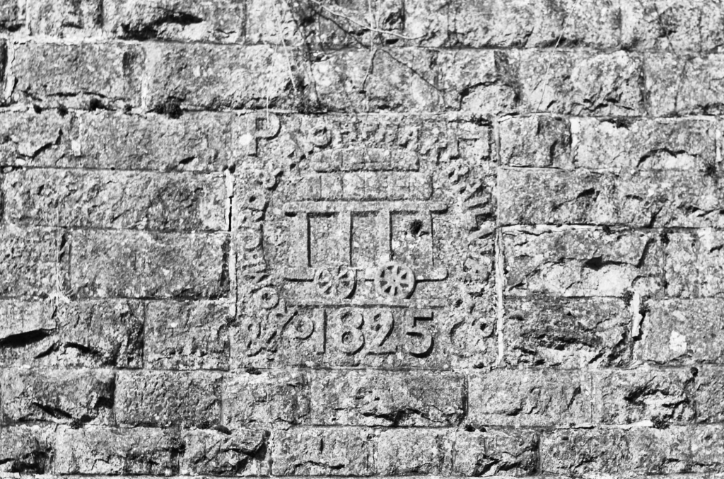
This is very early for a railway – the Stockton and Darlington opened in 1825, and the Liverpool & Manchester in 1830. It was initially believed that the friction between iron wheels and iron rails was too low for locomotives to do more than haul wagons along a level railroad. The earliest railways were therefore designed like canals, with flat sections joined together by inclines up which the wagons were hauled by a stationary steam engine and a rope or chain. It was in fact correct that the early locomotives could not haul wagons up an incline, but the reason was low power-to-weight ratio, not lack of friction. The very rapid development of steam locomotives soon removed this limitation. The incline out of Whaley Bridge, and the two steep inclines down to Cromford Wharf, continued using rope haulage until the line closed in 1967.
The Midland Railway’s line from Ashbourne to Buxton was opened in 1892, joining the C&HPR at Parsley Hay and partially or totally replacing the C&HPR north of Parsley Hay. The two railway lines are now popular trails through the Peak District from south of Dowlow quarry to Cromford and Ashbourne. North of Dowlow the original line can be followed in part. I will concentrate on this section, as books about the C&HPR tend to concentrate on what the line was like when working, not on what now remains. I will say a bit about interesting features along the High Peak Trail.
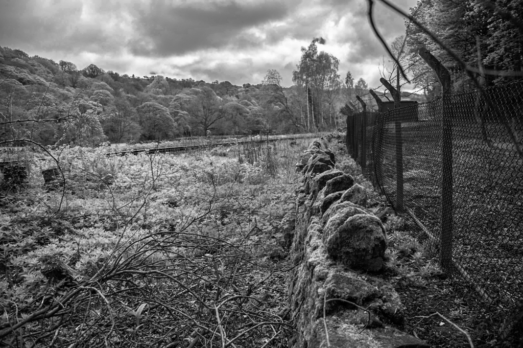
A 1:25,000 OS map is very useful for working out the original course of the railway, as most of the boundary walls are still in place, except in Brierlow and Hindlow Quarries and Dowlow Works, which are inaccessible anyway.
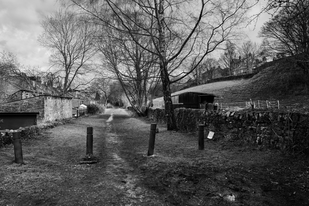
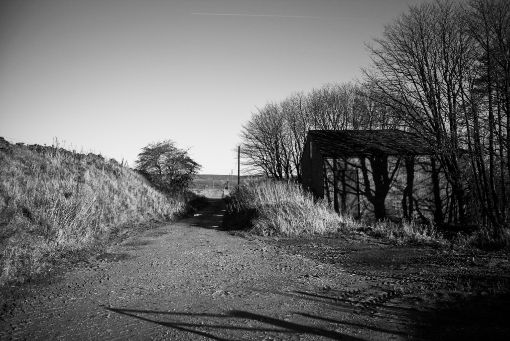
Whaley Bridge
The original terminus of the Peak Forest Canal was Bugsworth Basin, where limestone from the Dove Holes quarries was converted to lime and loaded into barges. The arm to Whaley Bridge terminates in a small basin with a transhipment shed for transferring goods to the C&HPR. Most of the first couple of kilometers from the basin has been restored as a linear park, up the Whaley Bridge and Shallcross inclines.
The transhipment shed at Whaley Bridge.
From the transhipment shed it is a a short walk to the bridge over the River Goyt and the foot of the Whaley Bridge incline.
The railway bridge over the River Goyt at the foot of the incline.
Looking up the Whaley Bridge Incline, which closed in 1952. The track turns to the right at the top where it levels out, and the site of the horse-worked capstan is obvious at the bend. The track then crosses Old Road.
Junction of Old Road and C&HPR, Whaley Bridge.
The railway line to Buxton crossed the C&HPR beyond Old Road. The bridge was very low, so that wagons for the basin had to be worked by horse from the Shallcross Yard on the west of the Buxton line. This is now blocked, so the route detours down to the A6, under the railway bridge, then back to the trackbed after the Cock Inn.
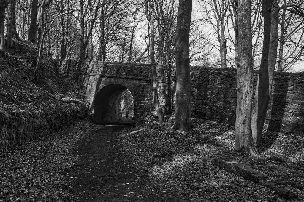
C&HPR trackbed, looking towards Shallcross Yard, Whaley Bridge.Tunnel beneath the Chapel-en-le-Frith road, Whaley Bridge.
It is then a pleasant walk through the tunnel under the Chapel-Whaley Bridge road to the foot of the Shallcross Incline off Shallcross Mill Road. The incline can be walked almost the the summit – the final section is covered by housing, and a slight detour leads to Shallcross Road.
Looking down the Shallcross Incline, Whaley Bridge.
The trackbed from here to the Fernilee Reservoir dam is on private land. A short distance up the road, at the junction of Elnor Lane and Old Road, the remains of Shallcross can be seen in a small enclosure.
Remains of Shallcross, Whaey Bridge.
To get to the trackbed by the Fernilee Reservoir dam, go along Elnor Lane with the trackbed clearly visible on the right. It is crossed several times by public footpaths. Elnor Lane joins the Buxton to Whaley Bridge turnpike, and a few hundred meters further on a private road descends to car parks at the dam. The trackbed comes in from the right at the bottom of the hill, and looks as if it could be walked from the public footpath at SK 0172 7855.
Errwood Reservoir – the course of the Cromford and High Peak Railway
Shallcross Incline to Burbage
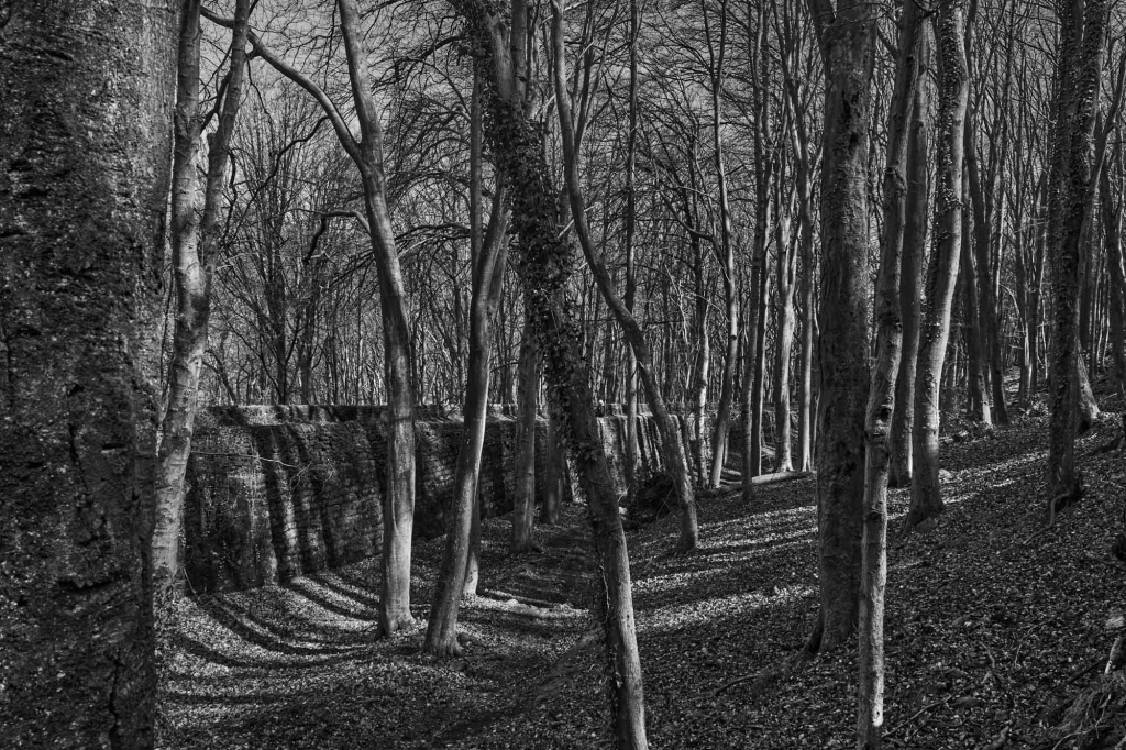
The track continues to the end of Fernilee Reservoir at the foot of the Burnsal incline, which is now a paved road. It continues past the reservoir at the top of the incline, continuing round to the Burbage Tunnel, which is sealed.
The trackbed from the reservoir at the top of Bunsall Incline, leading to Burbage Tunnel.The mouth of Burbage Tunnel.
There are two routes to the other end of the tunnel. A public footpath to Bishop’s Lane and Burbage crosses the track just before the tunnel. At Plex Lodge, follow the lane to Plex Farm and then the public footpath across the fields to Macclesfield Old Road, a couple of hundred meters below the trackbed. It is possible to continue past Plex Farm to the railway at Edgemoor Farm, and walk along the track to Macclesfield Old Road. This is not a public footpath, but a formal proposal has been made to add it to the Definitive Map. An alternative, with more interesting views, is to go up the steep and boggy footpath to the right of the tunnel mouth, and follow the wall along the top of Burbage Edge. At SK 0306 7271 the public footpath from the Goyt Valley to Burbage is joined at a stile, and followed down to Macclesfield Old road just above the trackbed.
Burbage to Ladmanlow
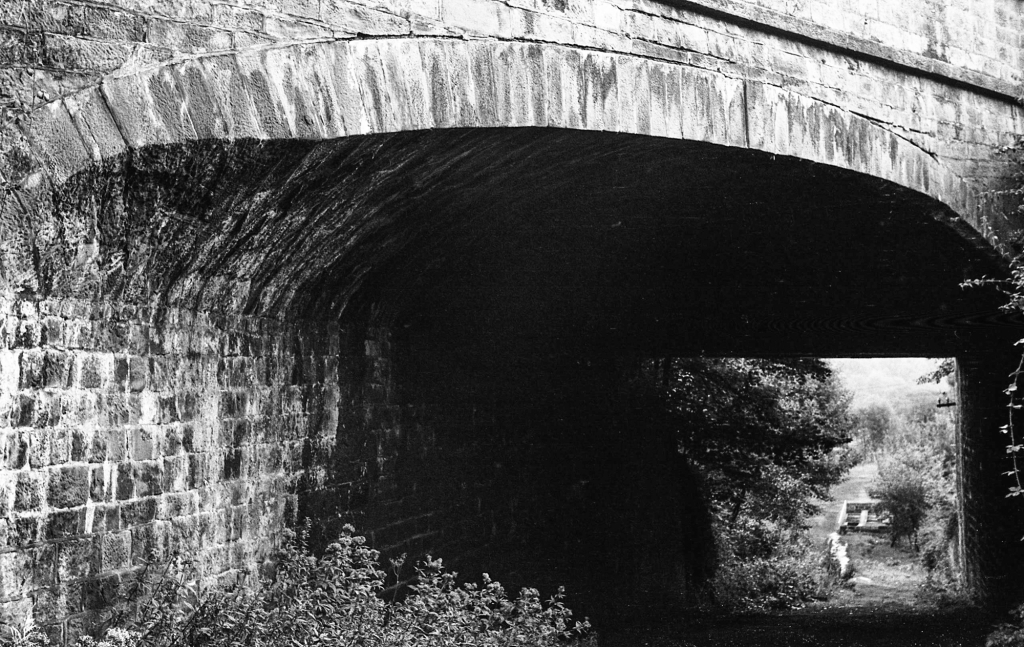
The tunnel under the old turnpike is buried on the north side, but accessible on the south side from a public footpath which starts a bit higher up Macclesfield Old Road.
The trackbed from Burbage Tunnel to the blocked tunnel under Macclesfield Old RoadThe Blocked tunnel under Macclesfield Old Road
The trackbed can be seen curving across a huge embankment towards the site of the bridge across the current Macclesfield Road, beyond which is Bridgehouse Farm and the former Ladmanlow Yard. A level shelf can be seen running from the embankment beneath the Macclesfield Road, starting at about SK 0362 7225. This was a siding for the Buxton Coal Mine. This area is riddled with small coal mines.
Macclesfield Old Road on the left, with the blocked tunnel mouth just visible
None of this is accessible. The railway crossed the Leek road at Ladmanlow, SK 0415 7185. The triangular area to the north of the road was the Ladmanlow Yard, and the straight track to the north east, which can be seen on the map, served lime kilns. The quarry is now a caravan park. After the Midland Railway line was opened, the C&HPR track from Hindlow to Ladmanlow was retained to serve the lime kilns.
Ladmanlow to Dowlow
To the south, the track across Stanley Moor is a surfaced road, but this is private and you could well be stopped by security guards from Harpur Hill, which is an industrial estate, and the current home of the Health and Safety Executive Laboratories. There is a public footpath starting opposite the entrance to the caravan park and Buxton Country Park which joins the trackbed at SK 0478 7033. From here, the trackbed is a public footpath on an embankment and through a cutting to SK 0607 7086. Another embankment, partly followed by a footpath, makes a big curve to the south, and there are remains of many other tracks into quarries and works. The trackbed can actually be followed, partly on public footpaths, all the way to the junction with Buxton line (which nows serves the quarries) at SK 0764 6998. Everything we have seen so far was built by the C&HPR. From here to the beginning of the High Peak Trail at SK 1105 6731 is active railway, and was built by the Midland Railway. The public footpath continues to Brierlow Bar, with an excellent bookshop and coffee bar, at SK 16900 81281.
The quietest route to the beginning of the next section is to follow the B5053 up the hill to the turning to Earl Sterndale, go through Earl Sterndale and turn left to Wheeldon Trees where you take a lane up left towards Hurdlow Grange. Over the brow of the hill is the bridle way leading north to the trackbed.
Dowlow to Parsley Hay
This section, to the junction just south of Parsley Hay, was rebuilt by the Midland Railway as part of their Buxton to Ashbourne line. There are two places were the original line can be seen. The first is the Hurdlow Incline.
The abandoned trackbed leading to the Hurdlow incline
The deviation to avoid the incline was opened in 1869. All the original track is on private land, but the course is quite clear on the map and can be seen from the lane between Wheeldon Trees and Sparklow. The track crosses the lane at SK 1146 6683. There is a large embankment south of the lane with a sharp curve to pass behind Hurdlow Grange. The incline crosses the fields to the east of Cronkston Low – the boundary walls can be seen from the lane. Further south, by Cotesfield Farm, the deviation cuts out two very sharp curves. The original route is on private land, but the boundary walls are obvious.
Parsley Hay to Middleton Top
Parsley Hay has a large car park and a cycle hire centre in the old station yard. Just south of the station was the junction between the new Midland Railway line and the C&HPR, and from there to Cromford Wharf we are following the original C&HPR route.
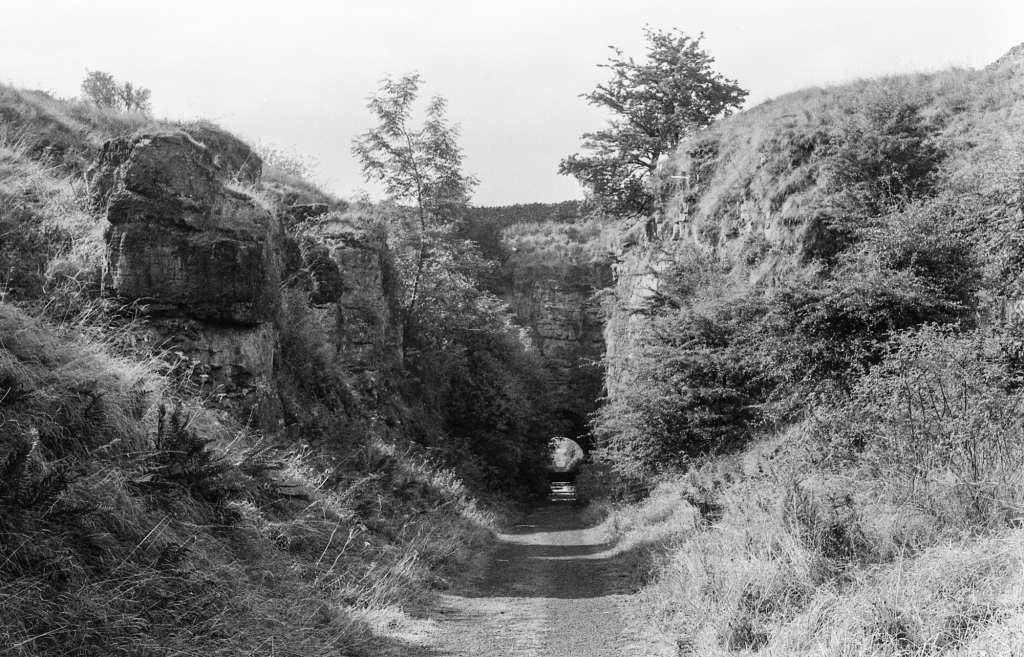
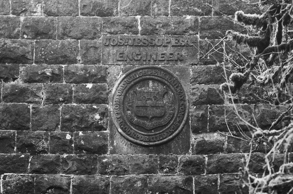
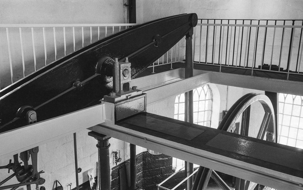
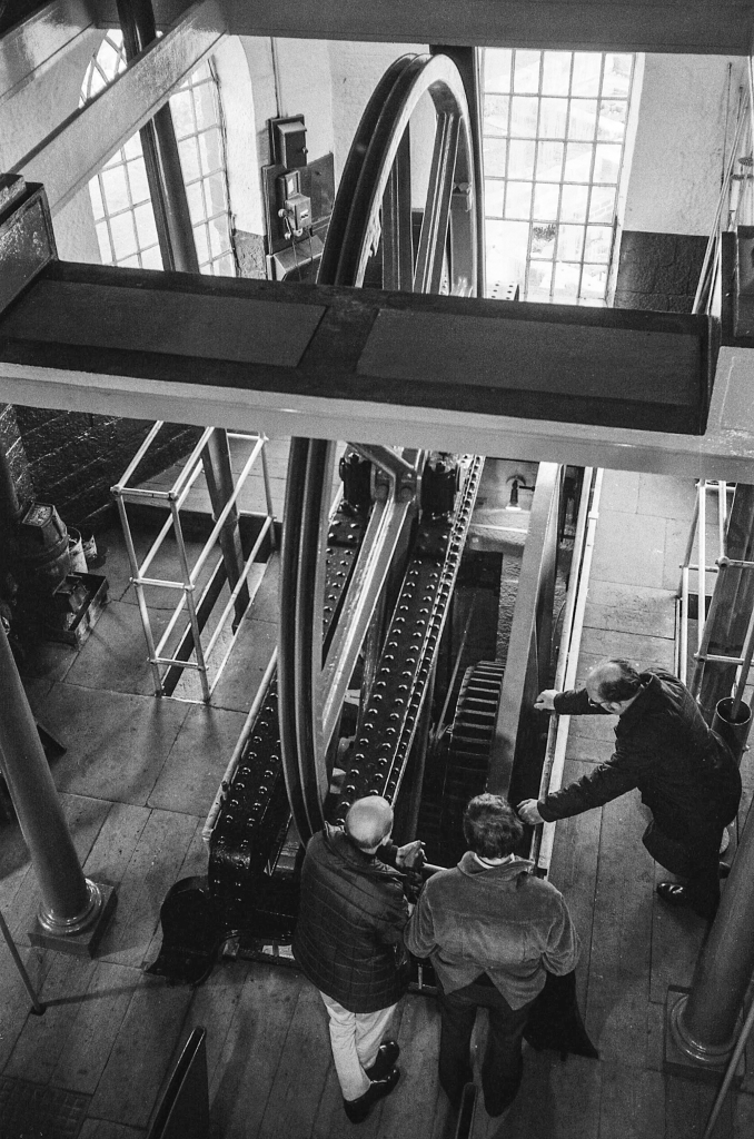
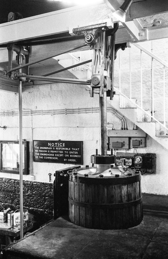
The tunnel under the Buxton to Newhaven turnpike. (1970-73)The north portal of the tunnel beneath Newhaven turnpike, showing the Coat of Arms and the engineer’s name – Josias Jessop.The tunnel beneath the Newhaven turnpike.The south portal of the tunnel beneath the Newhaven turnpike, showing the date that the enabling Act of Parliament was passed – shortly after the opening of the Stockton and Darlington Railway.Embankment near GothamMinninglow embankment, Cromford & High Peak Railway.Harborough Rocks.Middleton TopMiddleton Top Engine House 1970-73.
Middleton Top to Cromford Wharf
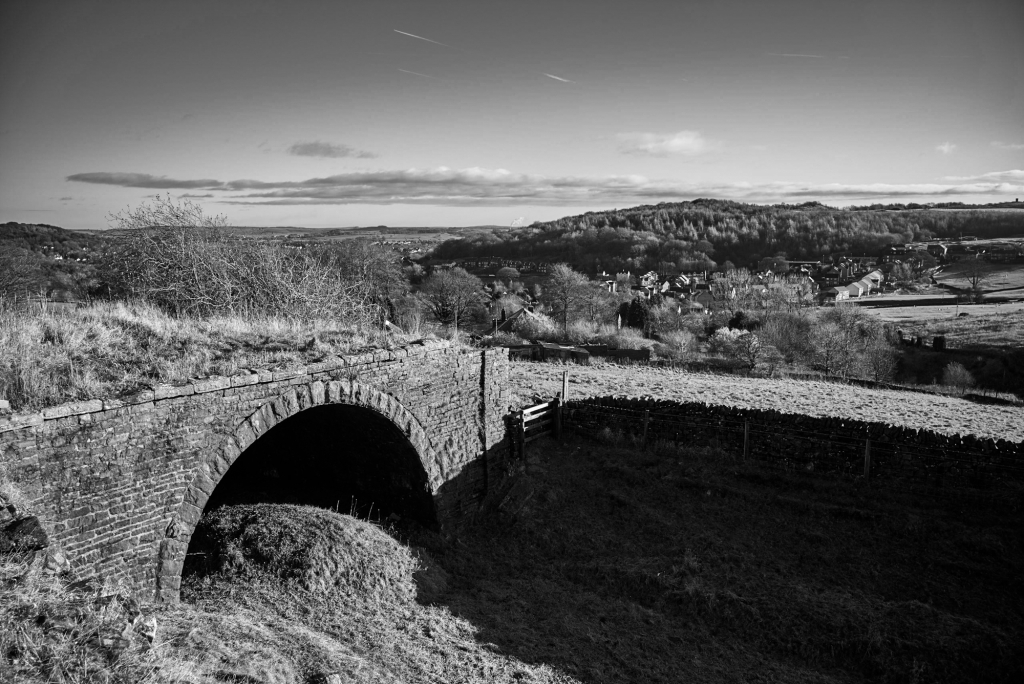
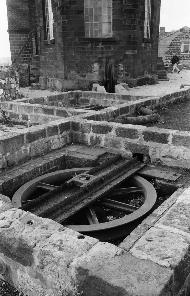
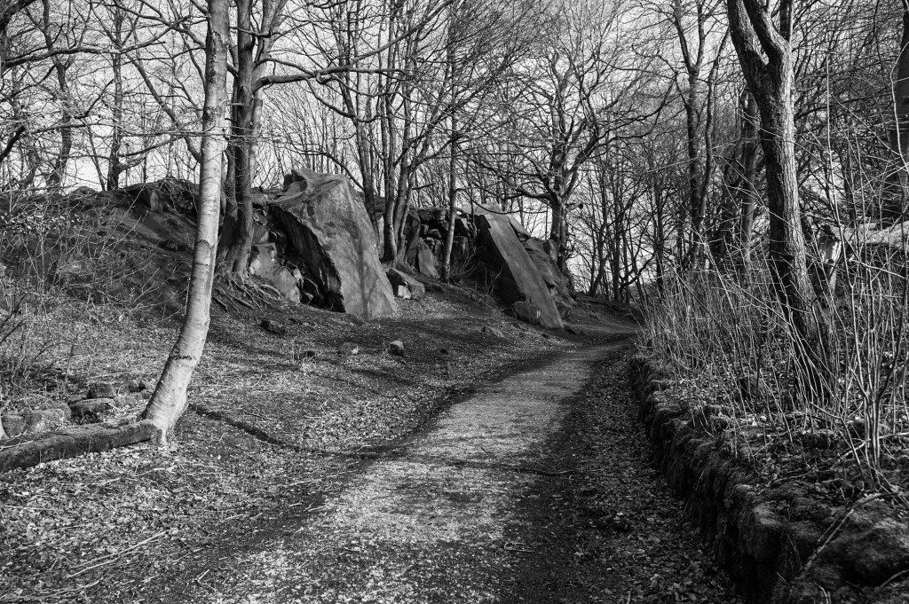
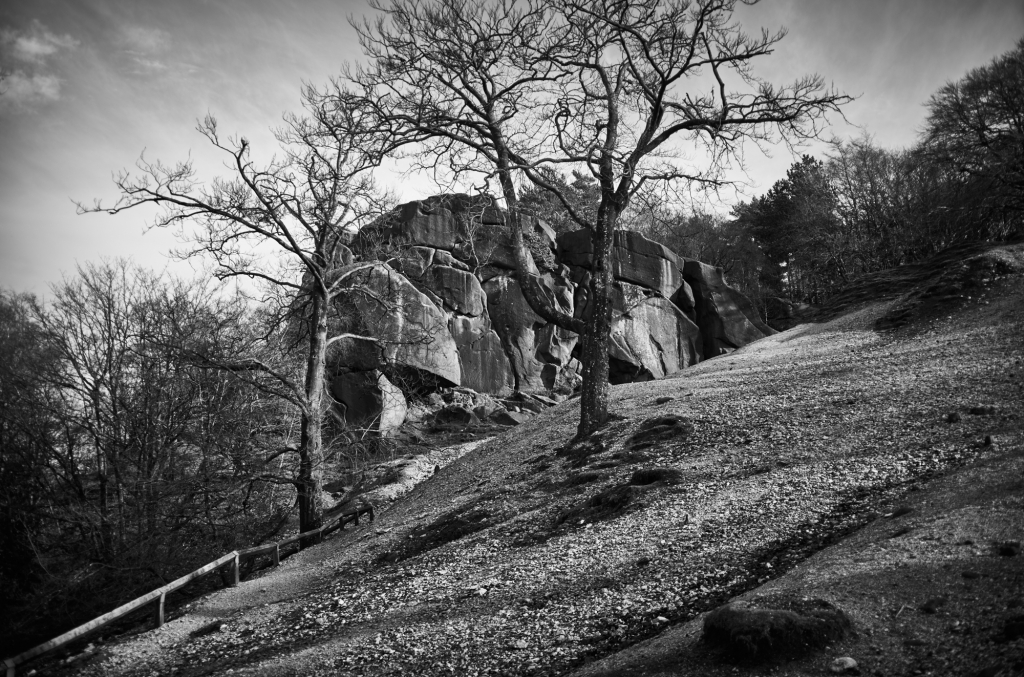
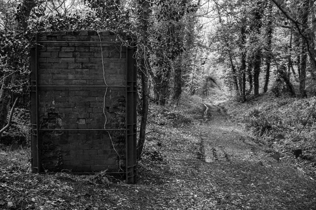
Cromford and High Peak Railway at Black RocksBlack RocksThe trackbed between Middleton and Sheep Pasture inclines.Sheep Pasture enginehouse from the top of the Sheep Pasture incline.Intake Lane bridge beneath the Sheep Pasture incline.Sheep Pasture incline.
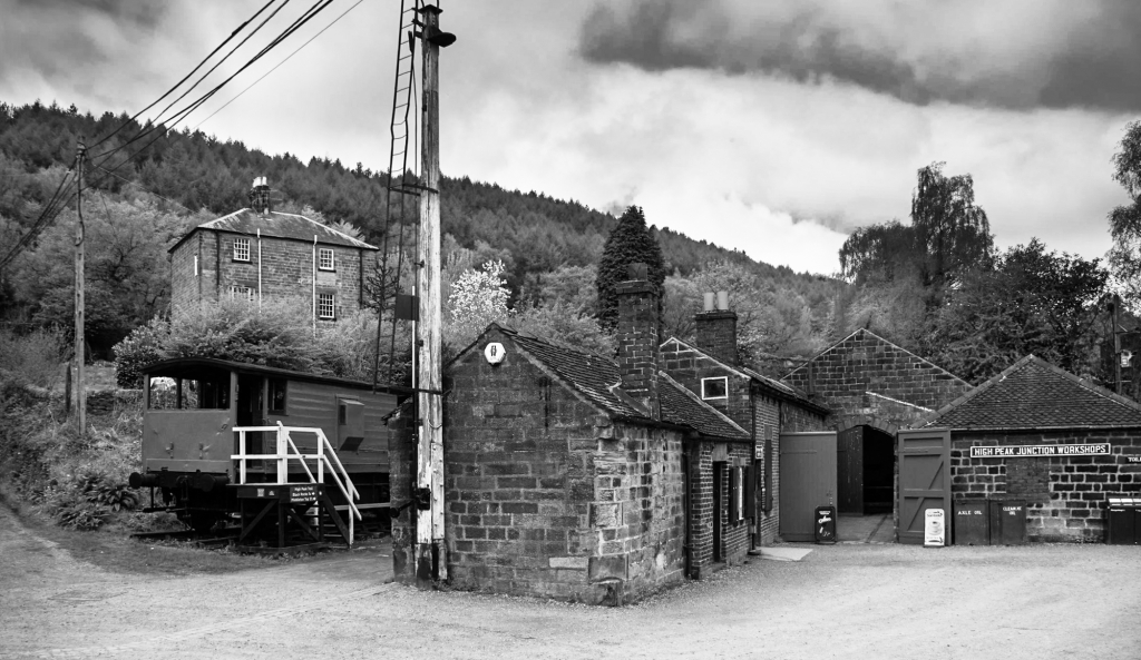
The yard at High Peak Junction on the Cromford Canal
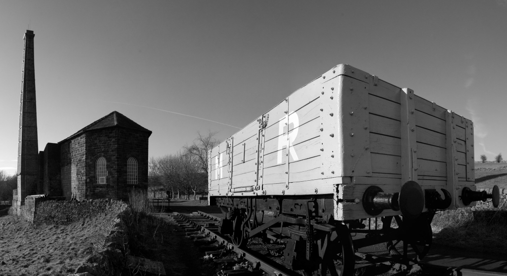
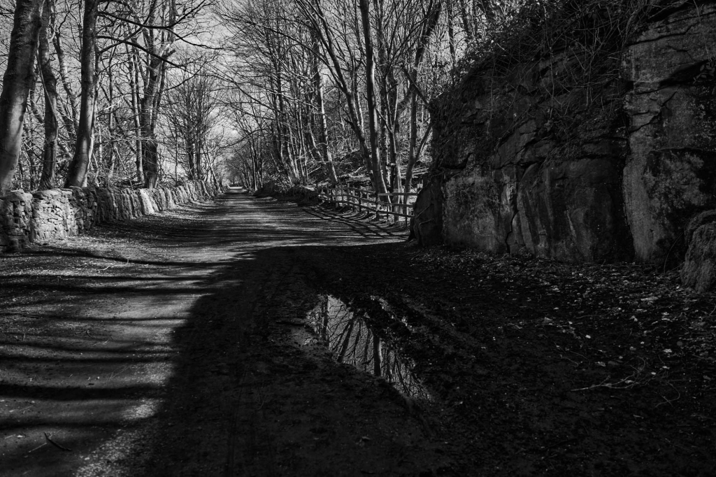
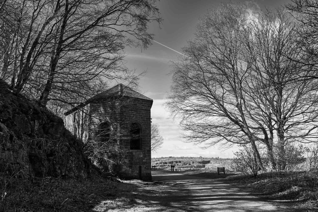
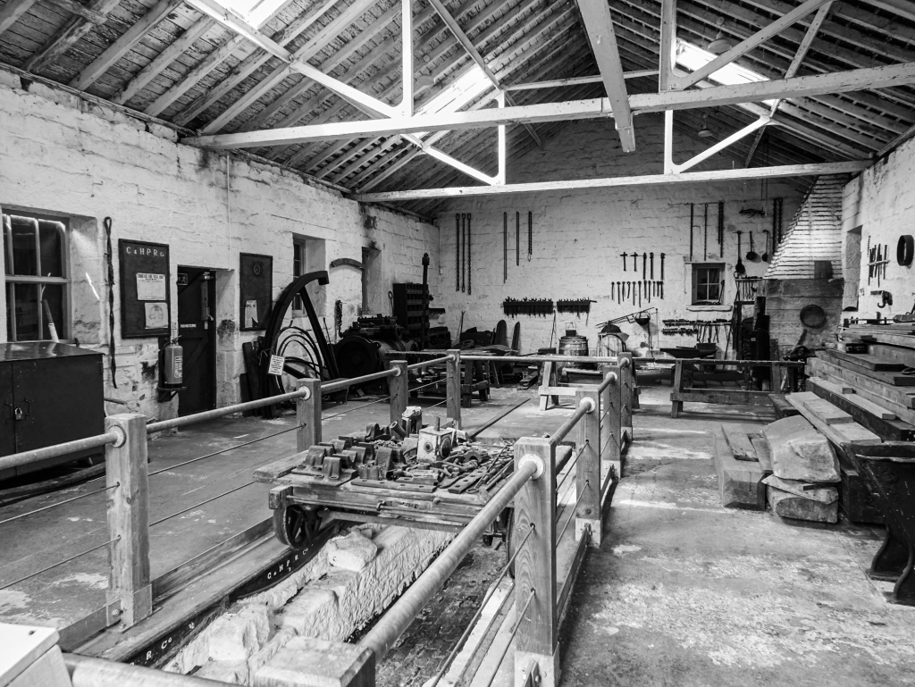
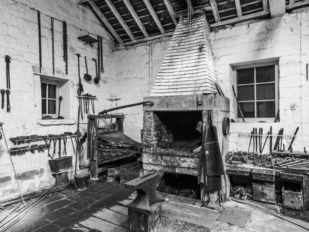
A6 bridge over the Sheep Pasture Incline and the catch pit. 1970-73.High Peak Junction workshops.High Peak Junction workshop.The transfer warehouse on the Cromford Canal.
The Connection the Main Line
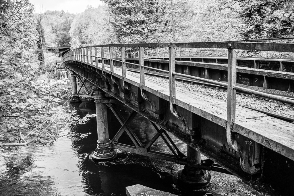
The extension to the junction with the Midland Railway.Cromford and High Peak Railway – High Peak Junction with the Midland line. The bridge (Midland line) across the Derwent.Cromford and High Peak Railway – High Peak Junction with the Midland line. The site of the junction.
Image Gallery
Click on any thumbnail to load higher resolution image.
Further reading
A Rimmer. The Cromford & High Peak Railway. The Oakwood Press 1985. ISBN 0 85361 319 2 John Marshall. The Cromford & High Peak Railway. Martin Bairstow 1996. ISBN 1 871944 14 7 A F Roberts and J T Leach. The Coal Mines of Buxton. Scarthin Books 2008. ISBN 978 0 90775 810 5 Colin E Mountford. Rope & Chain Haulage. Industrial Railway Society 2013. ISBN 1 901566 84 1
Getting to Switzerland is easy – take the RER from the Gare du Nord to the Gare de Lyon and get on the TGV to Genève or Lausanne. Or for a slower start, get off Eurostar at Lille Europe, have moules frites and a good beer for dinner, next day catch the TGV to Lyons and change to the TGV to Genève. Done.
Lac Léman and the Jet d’Eau at Genève.
A paddle steamer on Lac Léman. The young woman left of centre with her leg crossed is sketching the other passengers. First class passengers are on the upper deck.
Framed pastoral view from the Golden Pass Panoramic train between Montreux and Zweisimmen, on the way to Interlaken and the Berner Oberland. Mother and daughter are bored by the view.The Schynige Platte Railway, climbing from Wilderswil south of Interlaken to the hotel and Alpine Garden at Schynige Platte.Schynige Platte station and the entrance to the excellent Alpine Garden.The view north-east from Schynigge Platte. Looking south from the Schynige Platte Panoramaweg towards the Eiger, Mönch and Jungfrau. The Panoramaweg runs from Schynige Platte to the Berghotel Faulhorn. The dark mass in the middle distance is the Männlichen, reached by cable car from Wengen, with an excellent walk to Kleine Scheidegg.Eiger, Mönch and Jungfrau from the Panoramaweg.The Faulhorn (2680m) and Simelihorn (2751m). The Berghotel Faulhorn is just visible on the summit of the Faulhorn.Early morning at the Berghotel Faulhorn. View north over the Simelihorn to the Schreckhorn (4078 m) and Finsteraarhorn (4274 m).The Berghotel Faulhorn – the oldest Alpine hotel (1830).The railcar from Grütschalp to Mürren – maximum speed 30 km/h. Grütschalp is reached by cable car from Lauterbrunnen. Eiger, Mönch and Jungfrau from the high level path between Grütschalp and Mürren. The best views are when walking towards Mürren – use the railcar for the return journey.Eigerglescher Station on the Jungfraubahn, with the Eiger and Eigerglescher behind.The Mont Blanc Express to the Chamonix valley at Martigny.The Glacier du Trient from the path between Trient and the Fenêtre d’Arpette on the Walkers’ High Level Route from Chamonix to Zermatt.The Fenêtre d’Arpette – you will not be lonely on the Walkers’ High Level Route.The Matterhorn (4478m) and the Gornergrat Bahn.Anna views the Gornergrat panorama – Monte Rosa, Liskamm, Castor, Pollox, Briethorn, Klein Matterhorn and Matterhorn. This is a 180° panorama – hence the curved glacier.The Matterhorn from the Schwartzsee, with the chapel by the waterside.The chapel at Schwartzsee.The Matterhorn and Dente Blanche (4357 m).View north from Schwartzsee towards the Mischabel (4545m).
Travel details
Genève and Lausanne can be reached on the same day from London. The TGVs from the Gare de Lyon travel south very quickly before slowing down through the Jura – book an upper deck seat and enjoy the scenery. For the Berner Oberland you need to get to Interlaken from Montreux, which is further east along Lac Léman (Lake Geneva). Continuing on from Montreux, the Rhône Valley heads roughly south until Martigny, where it turns through a right-angle and heads north-east. The Mont Blanc Express is a marvellous slow journey into the Chamonix valley. Further east, the Postbus from Sion will take you to Arolla, and at Visp you change to the train for car-less Zermatt.
Dawdling is recommended – a stop in Paris is difficult to resist. The alternative route to Genève is via Lille or Lyon, both of which are worth a stop – for me, Lille is moules frites and beer, Lyons is Haute Cuisine. Genève has situation, paddle-steamers on Lac Léman, and snow-covered mountains on the horizon – and good food. Lausanne rises steeply from the lake, and the whole of the north side of the lake is vineyards.
Interlaken, as the name suggests, is on the flat ground between two lakes. To the south are the great north walls of the Eiger, Mönch and Jungfrau, with wonderful and accessible walking. From Interlaken, the Berner Oberland Bahn heads south, dividing at Zweilütschinen, one half of the train going to Grindelwald and the other half to Lauterbrunnen. From Grindelwald, a train goes up to Kleine Scheidegg, which is also reached by a train which climbs from Lauterbrunnen through car-less Wengen. From Kleine Scheidegg the train tunnels through the Eiger to the highest station in Europe, on the Jungfraujoch. Across the road from the station in Lauterbrunnen, a double-deck cable-car, with a freight truck on the lower deck, ascends to Grütschalp. From there, a railcar, towing the freight truck, trundles along a shelf high above the valley to Mürren, another car-less resort. If you get off the Lauterbrunnen train at Wilderswil, you can take the historic Schynige Platte Bahn up to the hotel at the beginning of the Panoramaweg.
At Zermatt, the Gornergratbahn goes up to the hotel on the Gornergrat, and wandering back down to one of the lower stations gives wonderful views from Monte Rosa round past the Matterhorn to the Mischabell. Cable cars acess high-level walking to the south, closer to the Matterhorn.
Image Gallery
Click on a thumbnail to open a higher resolution image.
I love wandering around cities – being a flâneur. I suppose, strictly (linguistically?) speaking, you have to be in France to be a flâneur, and where better to be a flâneur than in Paris. Anna and I tend to avoid the tourist attractions, the honey-pots, except early in the morning, and wander around the back streets or along the Canal Saint Martin. The area around Sacré-Cœur is thronged with tourists on a Sunday morning, but not far away there is open-air jazz in a peaceful square, and quiet cafés with not a tourist in sight. Not all the great buildings are thronged – it is usually quiet around Jules Hardouin-Mansart’s stupendous Dôme des Invalides. Whole areas are little known – Ménilmontant has quirky back streets and the Critérium Sauvage des Cascades, and in Belleville there is a wonderful quotation from Averroès (1126-1198) – ‘Ignorance leads to fear, fear to hate, hate to violence. There is the equation’. Surprisingly, even the Palais-Royal is quiet, and if your feet start to hurt, then retire to Shakespeare and Co for a book and coffee.
Metro entrance and a snappy dresser.Cafe and Perrier advert. You mean to say that you don’t sit around like this with your Perrier water? Quelle dommage!Canal Saint Martin.Sunday morning jazz in Place des Abbesses in Montmartre.Montmartre bar on a Sunday morning.The Dôme des Invalides at the Hôtel des Invalides, Paris.Ménilmontant. Notice for the 14th Critérium Sauvage des Cascades. The non-official rules say that the velocipede must have at least one wheel, and be driven by mechanical, intellectual or pataphysical force.Belleville. ‘Ignorance leads to fear, fear to hate, hate to violence. There is the equation’. Averroès (1126-1198). Plus ça change, plus c’est la même chose.The grand courtyard in the interior of the Palais Royal. The man (and the running boy) are about to go into the arcade which shelters the shops.Shakespeare and Co.Avignon TGV. The photographs displayed along the concourse are from Les Rencontres de la Photographie at Arles.
And so to Avignon – direct from St Pancras International to the great Rhone wines. Châteauneuf-du-Pape is a short bus ride away up the hill on the other side of the river. Gigondas and Vacqueyras are close by. And the food is not bad either. Avignon itself is very compact, the main street running from the station (Avignon station, not Avignon-TGV which is a short train ride from the town) to the Palais des Papes above a big square with gardens to one side.
Avignon, the Palais des Papes.Avignon. Pont Saint Bénézet – the original of ‘sur le pont d’Avignon’ – only three arches, which does not get you very far across the river.Avignon, Hotel Cloitre St Louis.
And then the Alps, which stretch in a great arc from the Mediterranean to the Swiss border at the head of the Chamonix valley, which is ‘mythique et authentique’ according to the official web site. Access by train is easy – unless SNCF is on strike, which has caught me out. The TGV to St Gervais leads into the Chamonix valley from the west – a wonderful line from Martigny gives access from the east – with Bourg-St Maurice further south, and the line to Turin gives access to the Vanoise at Modane.
The TGV to Turin at Modane station.
I started the Tour des Glaciers de la Vanoise – a superb walking tour – by taking a taxi from Modane to Plan d’Amont (€40 for ~45 minute drive). Then gentle walking to Refuge du Plan-Sec at 2350m. I did this in September – after the holiday season, so the refuges are only a third full, and the weather can be very fine, cold at night, but very good temperatures for walking. I was rather worried towards the end of the tour because snow was forecast, and I had to cross a col at nearly 3000m, and did not have crampons or ice axe, but there was not enough snow to be difficult.
Tour des Glaciers de la Vanoise: morning cloud at the Refuge de l’Arpont.Tour des Glaciers de la Vanoise: Mont Pelve.Tour des Glaciers de la Vanoise: Mont Pelve.Tour des Glaciers de la Vanoise. The new la Valette hut is in the centre of the image, the remains of the older hut on the higher shelf.Tour des Glaciers de la Vanoise: Ruisseau de RosoireTour des Glaciers de la Vanoise: view from the Pointe de l’Observatoire.
If you are not intending to climb Mont Blanc, there are five ways to get above the Chamonix valley – take the train towards Argentière and walk from there; take the lift to the Brévent, with magnificent views across the valley to Mont Blanc; take the train to the Mer de Glace, now much diminished; take the cable car to the Aiguille de Midi (and across to Courmayeur in Italy); or take the TMB (Tramway de Mont Blanc) towards the Aiguille de Bionassay. We have done all of these. Our last trip was on the TMB, which seems a bit like an unfinished project – at the end, the train pops out of a tunnel and stops, as if the line was never completed. Some of the earlier plans included a several hundred meter lift to the Dôme du Goûter. The walking options are limited at this height (2350m) – access to the Glacier du Bionassay, and for those attempting an ascent of Mont Blanc, the futuristic refuge on the Dôme de Goûter.
Aiguille du Bionassay from the top station of the TMB.
Image Gallery
Click on a thumbnail to open a higher resolution image.
When I was a kid, cycling was freedom, and, perhaps because we did little travelling, train journeys were adventure. It is difficult to imagine the excitement of travelling from Liverpool to Manchester in 1830 at the start of the railway age. It is pretty humdrum now though, travelling across the ‘bottomless’ Chat Moss in a diesel multiple unit. My introduction to long-distance train travel was in, I believe, 1963. I was a penniless student, and took the cheapest route to Hamburg, overnight from Calais. The third-class carriage had wooden seats, and I think it took 13 hours including a couple of hours stop in Köln. I remember standing in front of the Cathedral and seeing the towers disappearing upwards into the darkness. The whole journey from London took about 20 hours. It can now be done, in much more comfort, in about 11 hours by Eurostar and ICE.
When the Channel Tunnel opened in 1994, I grasped with both hands the opportunity to avoid the environmentally irresponsible tedium of air travel for business and pleasure journeys in Europe. In the past 20 years I have travelled many times, for work and pleasure, to France, Spain, Portugal, Belgium, the Netherlands, Switzerland and Germany. The journey begins under the magnificent train shed at St. Pancras International, designed by William Barlow and Rowland Mason Ordish – the largest single span roof in the world when it was built. The Paris end of the Eurostar route is equally magnificent – the great cathedral-like hall of the Gare du Nord.
The Gare du Nord looks simpler than St Pancras, but also has multiple layers of Metro and RER lines below the main concourse, and is the busiest station in Europe.
Brussels Midi is less exciting, but more convenient, with direct connections to the Netherlands and Germany. There is a direct service from London to Avignon.
Avignon TGV. The photographs displayed along the concourse are from Les Rencontres de la Photographie at Arles.
Some destinations are too far for one day – the TGV from Paris to Barcelona leaves early in the morning, but who would complain at having to spend an afternoon and evening in Paris? The sleeper train to Munich – another magnificent station – allows time for being a flâneur and having dinner.
The train trips usually involve some wandering around cities and walking in mountains. The first two are about France and Switzerland, and amalgamate trips spread over the past 20 years.
Image Gallery
Click on a thumbnail to open a high resolution image in a new tab.


")


 across the Derwent near the C&HPR junction")


 and Simelihorn (2751m). The Berghotel Faulhorn is just visible on the summit of the Faulhorn.")
 and Finsteraarhorn (4274 m).")
.")


, Switzerland.")
.")


. Plus ça change, plus c'est la même chose.")
 are about to go into the arcade which shelters the shops.")


