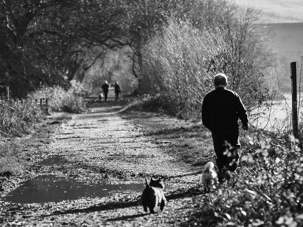
The headwaters of the Derbyshire Derwent are on the south side of Bleaklow, between Swain’s Greave in the west and Featherbed Moss in the east. Featherbed Moss is a common name in the Penines – Bleaklow has two of them. The Derwent flows south through Howden, Upper Derwent and Ladybower Reservoirs and under about twenty old bridges before joining the Trent south of Derby at Derwent Mouth. The river runs through the Peak District National Park until just north of Rowsley, and then follows the eastern edge of the park down to Cromford.
The Peak District has been farmed for several thousand years, and lead mining pre-dates the Roman occupation. The limestone uplands were monastic sheep runs on an industrial scale in the mediaeval period. The factory system began in the Derwent Valley, which is a World Heritage Site from Cromford down to Derby – the inscription reads: Criterion(ii): The Derwent Valley saw the birth of the factory system, when new types of building were erected to house the new technology for spinning cotton developed by Richard Arkwright in the early 19th century. Criterion (iv): In the Derwent Valley for the first time there was large-scale industrial production in a hitherto rural landscape. The need to provide housing and other facilities for workers and managers resulted in the creation of the first modern industrial towns.
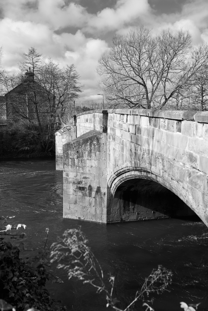
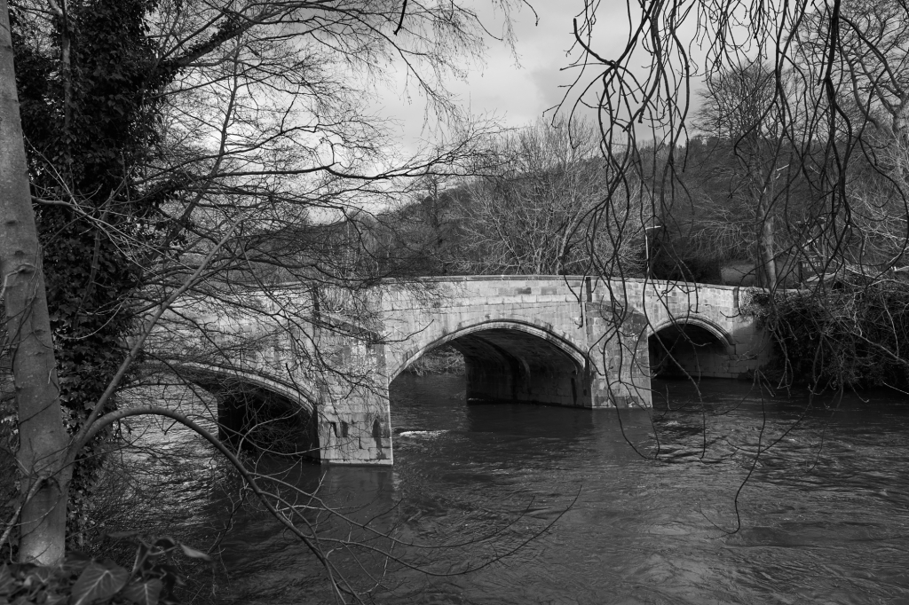
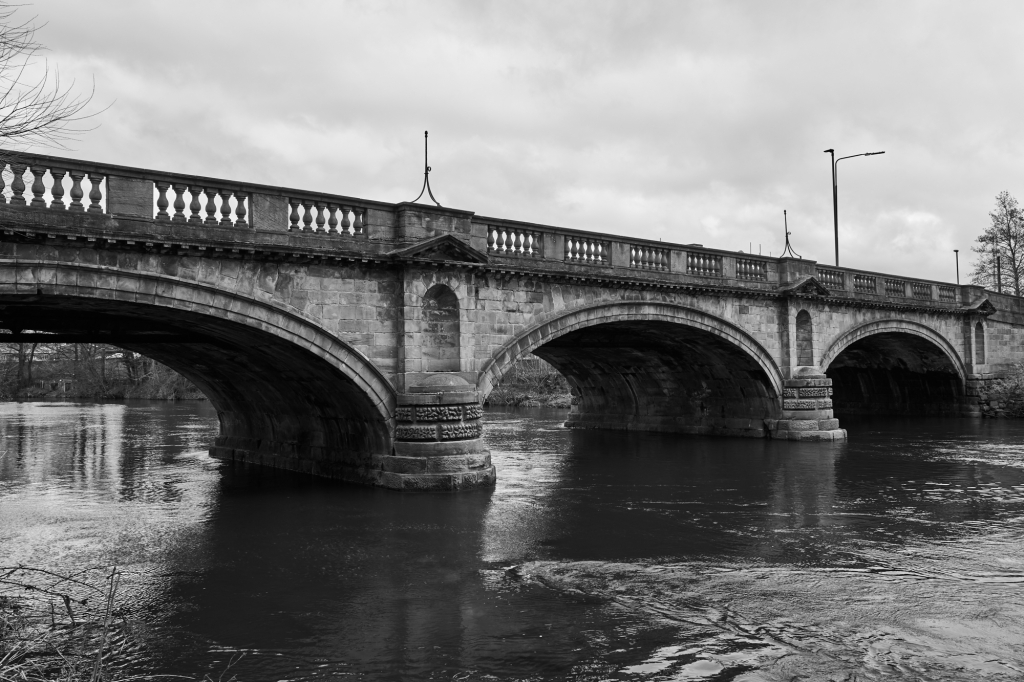
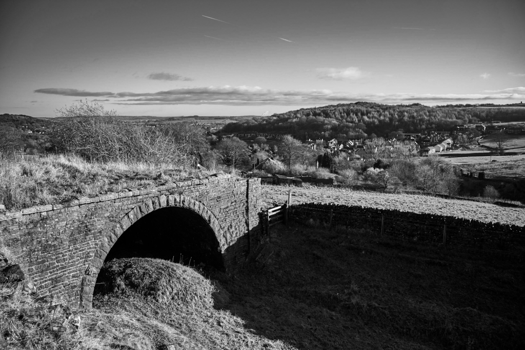
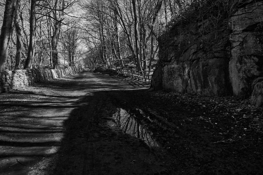
For the past two hundred years the river valley north of Derby has been a major traffic route, with the Cromford Canal, the railway line from London to Sheffield (and earlier to Manchester as well), and the A6 road from London to Carlisle. The A6 still uses most of the old bridges – very few have been replaced by modern bridges. Most of the bridges have been widened. It was usual to take down the masonry on the side that eas being widened, and re-erect the masonry to preserve the bridge’s appearance. Before the early 19th century, there was no continuous route up the valley – the traffic was largely between east and west, with the river being a major obstacle.
Slippery Stones (Grade II listed)Slippery Stones (Grade II listed).Slippery Stones (Grade II listed) .Yorkshire Bridge (Grade II listed).Yorkshire Bridge (Grade II listed).Mytham BridgeMytham BridgeLeadmill Bridge (Grade II listed).Grindleford Bridge (Grade II listed and Scheduled Monument).Froggatt Bridge (Scheduled Monument).Froggatt Bridge (Scheduled Monument).New BridgeNew BridgeCalver Bridge (Grade II* listed).Calver Bridge (Grade II* listed).Calver Bridge (Grade II* listed).Baslow Bridge (Grade I Listed and Scheduled Monument).Baslow Bridge (Grade I Listed and Scheduled Monument).Baslow Bridge (Grade I Listed and Scheduled Monument).Chatsworth Bridge (Grade I Listed).Chatsworth Bridge (Grade I Listed).One Arch Bridge, Chatsworth (Grade II* Listed and Scheduled Monument).Rowsley Bridge (Grade II* Listed and Scheduled Monument).Rowsley Bridge (Grade II* Listed and Scheduled Monument).Darley Bridge (Grade II* Listed and Scheduled Monument).Darley Bridge (Grade II* Listed and Scheduled Monument).Matlock Bridge (Grade II* Listed and Scheduled Monument).Cromford Bridge (Grade II* Listed and Scheduled Monument).Whatstandwell Bridge (Grade II Listed).Ambergate Bridge (Halfpenny Bridge) (Grade II Listed).Ambergate Bridge (Halfpenny Bridge) (Grade II Listed).Ambergate Bridge (Halfpenny Bridge) (Grade II Listed).Belper Bridge (Grade II Listed).Milford Bridge (Grade II Listed).Duffield Bridge (Grade II* Listed and Scheduled Monument)Duffield Bridge (Grade II* Listed and Scheduled Monument)Derby St Mary’s Bridge (Grade II* Listed and Scheduled Monument)
Listed Buildings and Scheduled Monuments
Listing is a local procedure and there is a statutory consultation process before the listing is confirmed. Scheduling is a national procedure and no consultation is required. Both give statutory protection, with scheduling taking precedence over listing. It is not obvious to me why a Scheduled Monument would also be Listed. For more information, see Heritage Help
The Cromford Canal, giving access to the Trent, was built by William Jessop and opened in 1792. The Peak Forest Canal from Manchester to Bugsworth and Whaley Bridge, engineered by Benjamin Outram, was opened in 1800. There was a proposal for a canal joining the two canals along the line of the C&HPR which was abandoned because of the lack of water at the highest level. Each boat passing up or down the locks removes a lockful of water from the summit level, and there is no source of water on the limestone plateau. A feasible route was surveyed by John Rennie. The route was up the Derwent Valley to Hope, then to the head of Edale and a tunnel nearly three miles long to Chapel Milton, roughly along the line of the Cowburn Tunnel on the Hope Valley Line. The estimated cost, in 1810, was the enormous sum of £650,000. Needless to say, it was not built. In 1824 Josias Jessop was appointed to prepare a survey of a railway line from Whaley Bridge to Cromford. His estimated cost was a more reasonable £150,000, but his estimates of the potential revenue seem with hindsight to have been wildly optimistic.
This is very early for a railway – the Stockton and Darlington opened in 1825, and the Liverpool & Manchester in 1830. It was initially believed that the friction between iron wheels and iron rails was too low for locomotives to do more than haul wagons along a level railroad. The earliest railways were therefore designed like canals, with flat sections joined together by inclines up which the wagons were hauled by a stationary steam engine and a rope or chain. It was in fact correct that the early locomotives could not haul wagons up an incline, but the reason was low power-to-weight ratio, not lack of friction. The very rapid development of steam locomotives soon removed this limitation. The incline out of Whaley Bridge, and the two steep inclines down to Cromford Wharf, continued using rope haulage until the line closed in 1967.
The Midland Railway’s line from Ashbourne to Buxton was opened in 1892, joining the C&HPR at Parsley Hay and partially or totally replacing the C&HPR north of Parsley Hay. The two railway lines are now popular trails through the Peak District from south of Dowlow quarry to Cromford and Ashbourne. North of Dowlow the original line can be followed in part. I will concentrate on this section, as books about the C&HPR tend to concentrate on what the line was like when working, not on what now remains. I will say a bit about interesting features along the High Peak Trail.
A 1:25,000 OS map is very useful for working out the original course of the railway, as most of the boundary walls are still in place, except in Brierlow and Hindlow Quarries and Dowlow Works, which are inaccessible anyway.
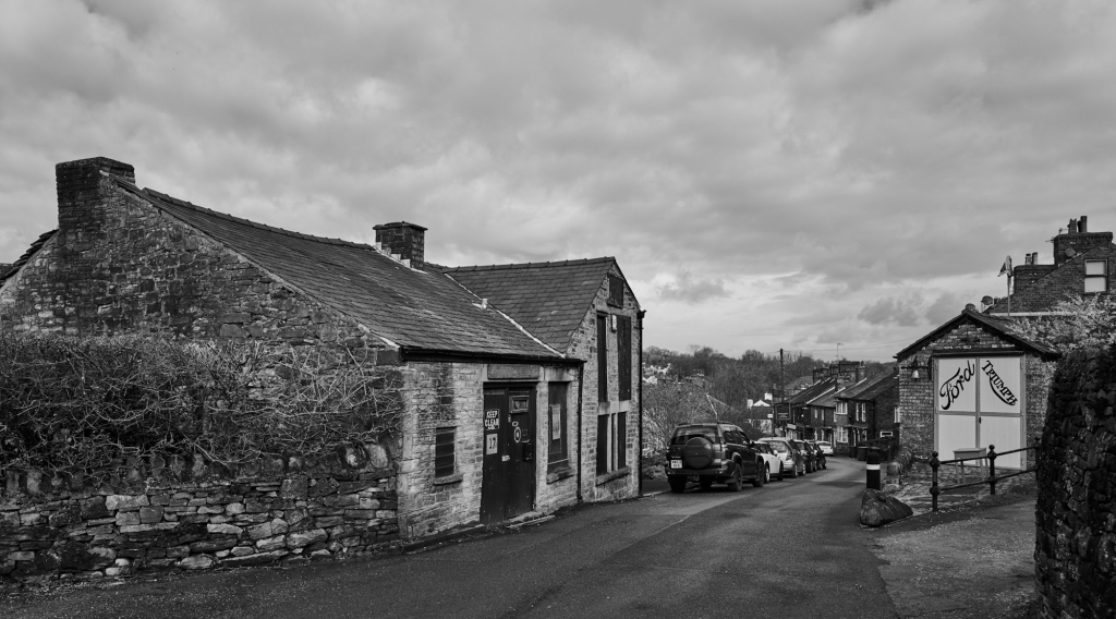
Whaley Bridge
The original terminus of the Peak Forest Canal was Bugsworth Basin, where limestone from the Dove Holes quarries was converted to lime and loaded into barges. The arm to Whaley Bridge terminates in a small basin with a transhipment shed for transferring goods to the C&HPR. Most of the first couple of kilometers from the basin has been restored as a linear park, up the Whaley Bridge and Shallcross inclines.
The transhipment shed at Whaley Bridge.
From the transhipment shed it is a a short walk to the bridge over the River Goyt and the foot of the Whaley Bridge incline.
The railway bridge over the River Goyt at the foot of the incline.
Looking up the Whaley Bridge Incline, which closed in 1952. The track turns to the right at the top where it levels out, and the site of the horse-worked capstan is obvious at the bend. The track then crosses Old Road.
Junction of Old Road and C&HPR, Whaley Bridge.
The railway line to Buxton crossed the C&HPR beyond Old Road. The bridge was very low, so that wagons for the basin had to be worked by horse from the Shallcross Yard on the west of the Buxton line. This is now blocked, so the route detours down to the A6, under the railway bridge, then back to the trackbed after the Cock Inn.
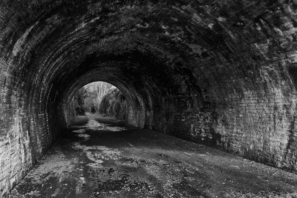
C&HPR trackbed, looking towards Shallcross Yard, Whaley Bridge.Tunnel beneath the Chapel-en-le-Frith road, Whaley Bridge.
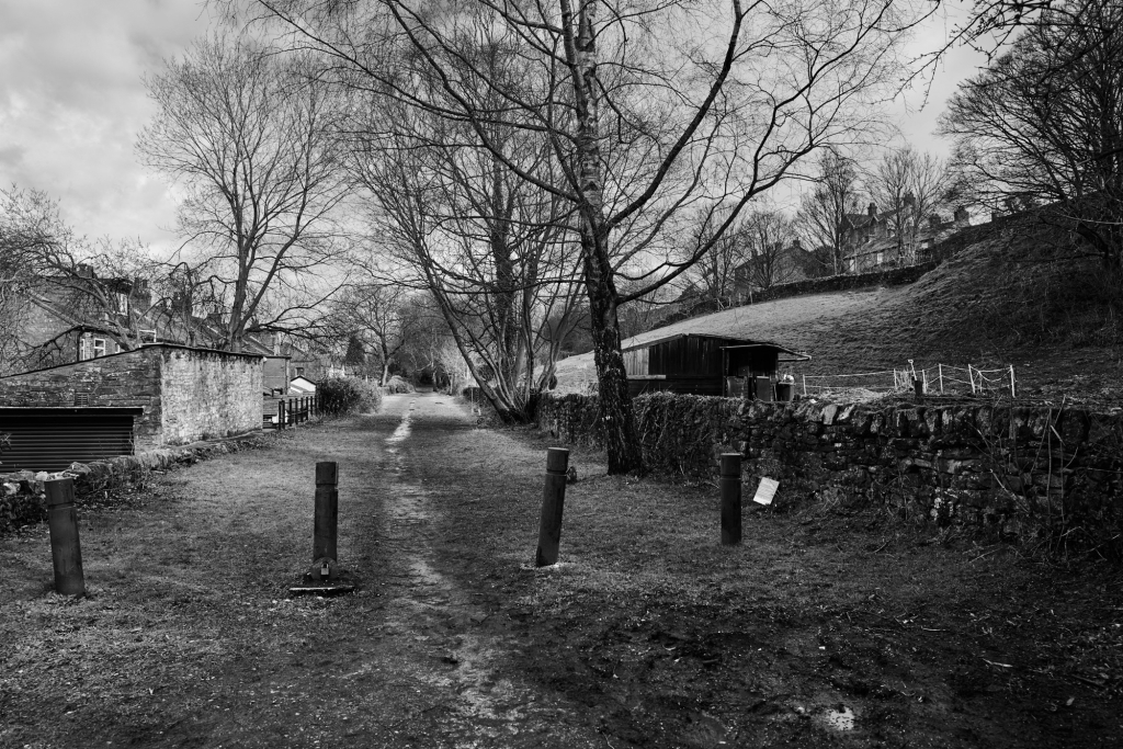
It is then a pleasant walk through the tunnel under the Chapel-Whaley Bridge road to the foot of the Shallcross Incline off Shallcross Mill Road. The incline can be walked almost the the summit – the final section is covered by housing, and a slight detour leads to Shallcross Road.
Looking down the Shallcross Incline, Whaley Bridge.
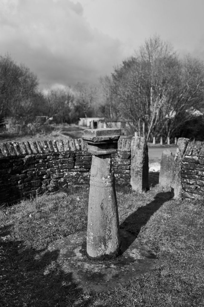
The trackbed from here to the Fernilee Reservoir dam is on private land. A short distance up the road, at the junction of Elnor Lane and Old Road, the remains of Shallcross can be seen in a small enclosure.
Remains of Shallcross, Whaey Bridge.
To get to the trackbed by the Fernilee Reservoir dam, go along Elnor Lane with the trackbed clearly visible on the right. It is crossed several times by public footpaths. Elnor Lane joins the Buxton to Whaley Bridge turnpike, and a few hundred meters further on a private road descends to car parks at the dam. The trackbed comes in from the right at the bottom of the hill, and looks as if it could be walked from the public footpath at SK 0172 7855.
Errwood Reservoir – the course of the Cromford and High Peak Railway
Shallcross Incline to Burbage
The track continues to the end of Fernilee Reservoir at the foot of the Burnsal incline, which is now a paved road. It continues past the reservoir at the top of the incline, continuing round to the Burbage Tunnel, which is sealed.
The trackbed from the reservoir at the top of Bunsall Incline, leading to Burbage Tunnel.The mouth of Burbage Tunnel.
There are two routes to the other end of the tunnel. A public footpath to Bishop’s Lane and Burbage crosses the track just before the tunnel. At Plex Lodge, follow the lane to Plex Farm and then the public footpath across the fields to Macclesfield Old Road, a couple of hundred meters below the trackbed. It is possible to continue past Plex Farm to the railway at Edgemoor Farm, and walk along the track to Macclesfield Old Road. This is not a public footpath, but a formal proposal has been made to add it to the Definitive Map. An alternative, with more interesting views, is to go up the steep and boggy footpath to the right of the tunnel mouth, and follow the wall along the top of Burbage Edge. At SK 0306 7271 the public footpath from the Goyt Valley to Burbage is joined at a stile, and followed down to Macclesfield Old road just above the trackbed.
Burbage to Ladmanlow
The tunnel under the old turnpike is buried on the north side, but accessible on the south side from a public footpath which starts a bit higher up Macclesfield Old Road.
The trackbed from Burbage Tunnel to the blocked tunnel under Macclesfield Old RoadThe Blocked tunnel under Macclesfield Old Road
The trackbed can be seen curving across a huge embankment towards the site of the bridge across the current Macclesfield Road, beyond which is Bridgehouse Farm and the former Ladmanlow Yard. A level shelf can be seen running from the embankment beneath the Macclesfield Road, starting at about SK 0362 7225. This was a siding for the Buxton Coal Mine. This area is riddled with small coal mines.
Macclesfield Old Road on the left, with the blocked tunnel mouth just visible
None of this is accessible. The railway crossed the Leek road at Ladmanlow, SK 0415 7185. The triangular area to the north of the road was the Ladmanlow Yard, and the straight track to the north east, which can be seen on the map, served lime kilns. The quarry is now a caravan park. After the Midland Railway line was opened, the C&HPR track from Hindlow to Ladmanlow was retained to serve the lime kilns.
Ladmanlow to Dowlow
To the south, the track across Stanley Moor is a surfaced road, but this is private and you could well be stopped by security guards from Harpur Hill, which is an industrial estate, and the current home of the Health and Safety Executive Laboratories. There is a public footpath starting opposite the entrance to the caravan park and Buxton Country Park which joins the trackbed at SK 0478 7033. From here, the trackbed is a public footpath on an embankment and through a cutting to SK 0607 7086. Another embankment, partly followed by a footpath, makes a big curve to the south, and there are remains of many other tracks into quarries and works. The trackbed can actually be followed, partly on public footpaths, all the way to the junction with Buxton line (which nows serves the quarries) at SK 0764 6998. Everything we have seen so far was built by the C&HPR. From here to the beginning of the High Peak Trail at SK 1105 6731 is active railway, and was built by the Midland Railway. The public footpath continues to Brierlow Bar, with an excellent bookshop and coffee bar, at SK 16900 81281.
The quietest route to the beginning of the next section is to follow the B5053 up the hill to the turning to Earl Sterndale, go through Earl Sterndale and turn left to Wheeldon Trees where you take a lane up left towards Hurdlow Grange. Over the brow of the hill is the bridle way leading north to the trackbed.
Dowlow to Parsley Hay
This section, to the junction just south of Parsley Hay, was rebuilt by the Midland Railway as part of their Buxton to Ashbourne line. There are two places were the original line can be seen. The first is the Hurdlow Incline.
The abandoned trackbed leading to the Hurdlow incline
The deviation to avoid the incline was opened in 1869. All the original track is on private land, but the course is quite clear on the map and can be seen from the lane between Wheeldon Trees and Sparklow. The track crosses the lane at SK 1146 6683. There is a large embankment south of the lane with a sharp curve to pass behind Hurdlow Grange. The incline crosses the fields to the east of Cronkston Low – the boundary walls can be seen from the lane. Further south, by Cotesfield Farm, the deviation cuts out two very sharp curves. The original route is on private land, but the boundary walls are obvious.
Parsley Hay to Middleton Top
Parsley Hay has a large car park and a cycle hire centre in the old station yard. Just south of the station was the junction between the new Midland Railway line and the C&HPR, and from there to Cromford Wharf we are following the original C&HPR route.
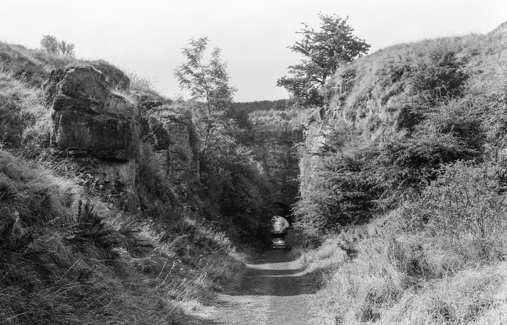
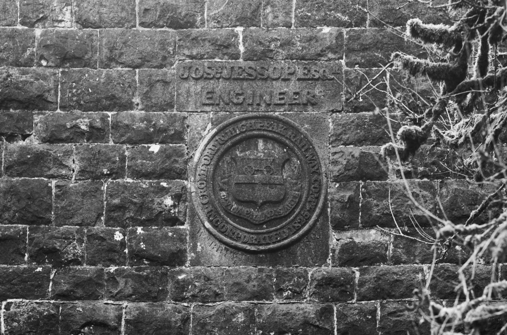
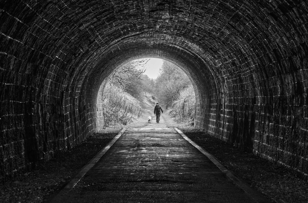
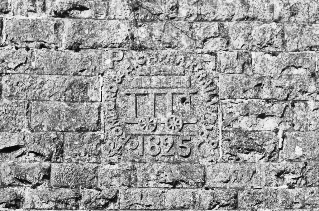
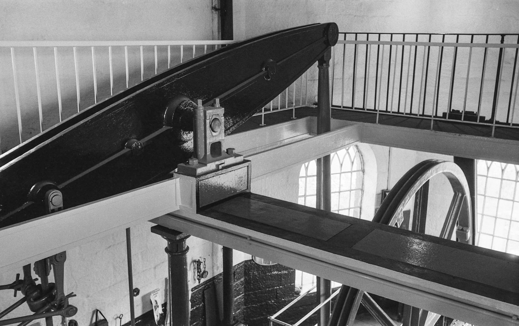
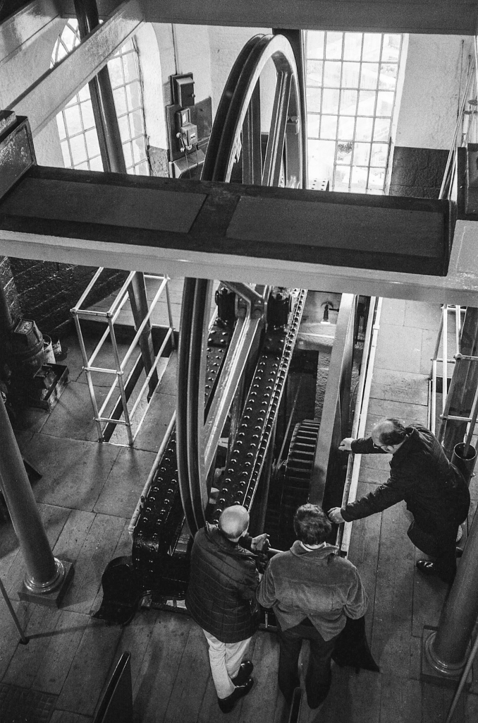
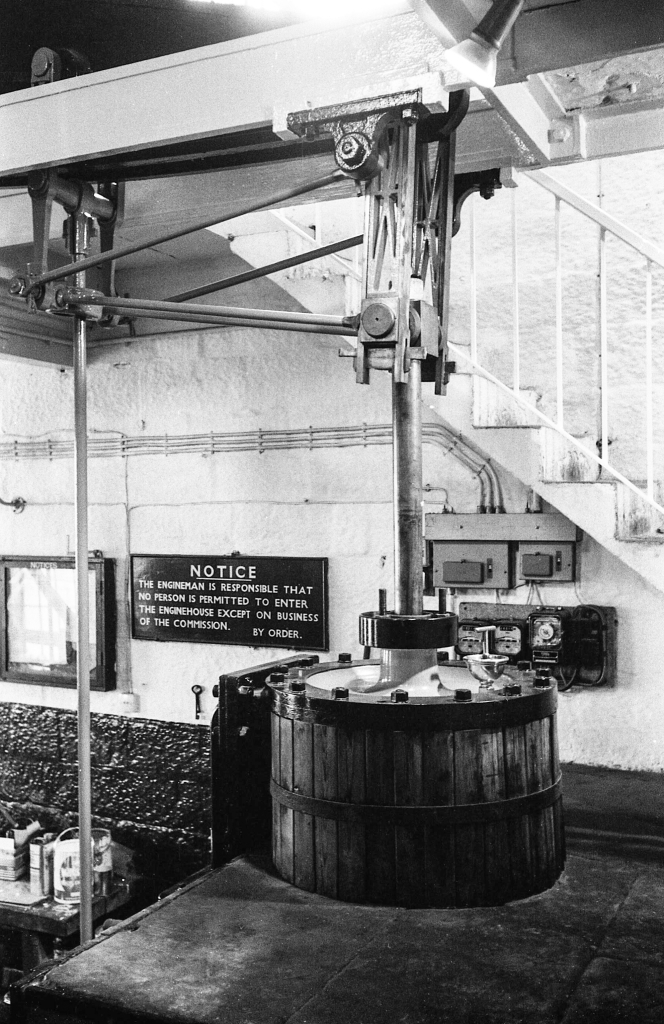
The tunnel under the Buxton to Newhaven turnpike. (1970-73)The north portal of the tunnel beneath Newhaven turnpike, showing the Coat of Arms and the engineer’s name – Josias Jessop.The tunnel beneath the Newhaven turnpike.The south portal of the tunnel beneath the Newhaven turnpike, showing the date that the enabling Act of Parliament was passed – shortly after the opening of the Stockton and Darlington Railway.Embankment near GothamMinninglow embankment, Cromford & High Peak Railway.Harborough Rocks.Middleton TopMiddleton Top Engine House 1970-73.
Middleton Top to Cromford Wharf
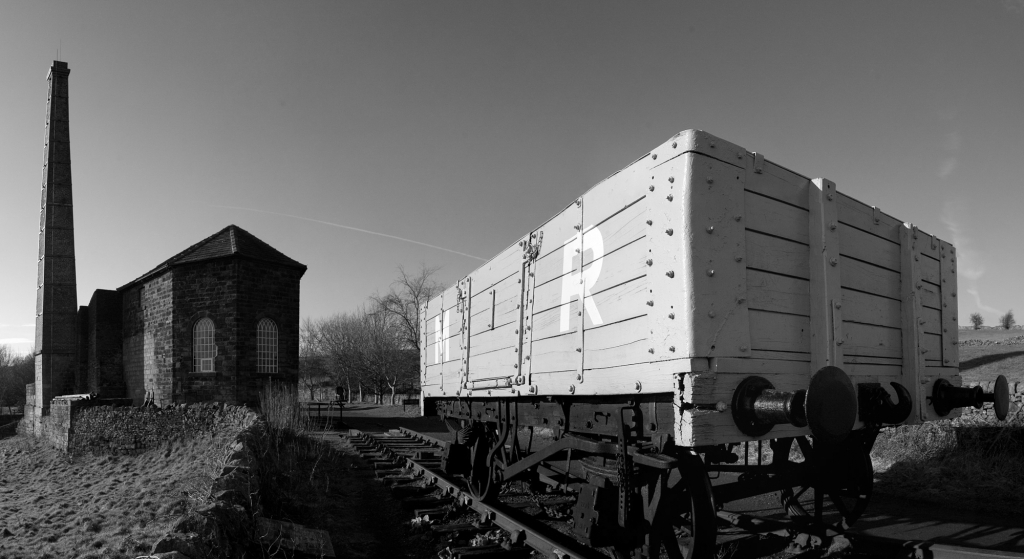
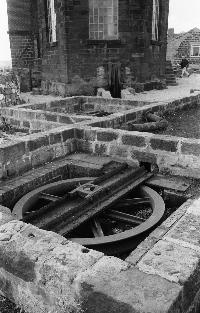
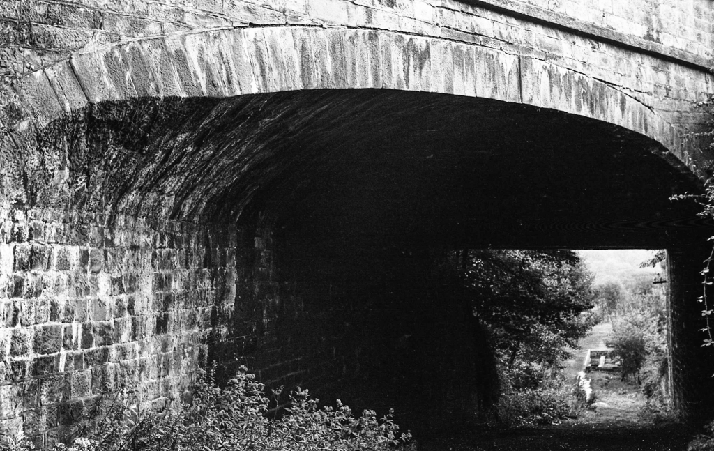
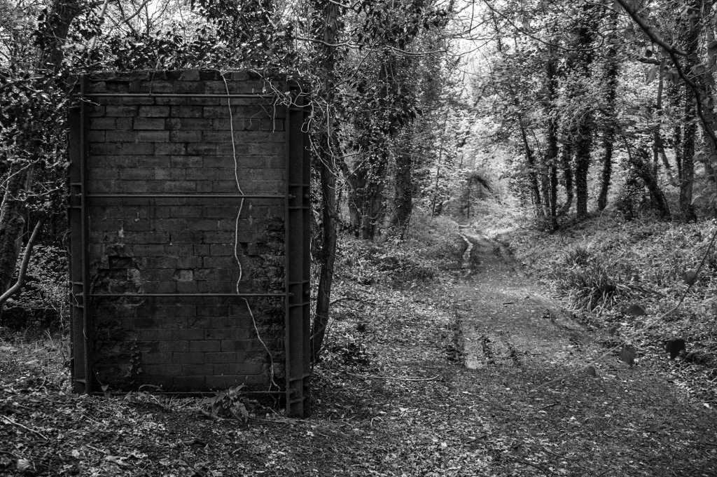
Cromford and High Peak Railway at Black RocksBlack RocksThe trackbed between Middleton and Sheep Pasture inclines.Sheep Pasture enginehouse from the top of the Sheep Pasture incline.Intake Lane bridge beneath the Sheep Pasture incline.Sheep Pasture incline.
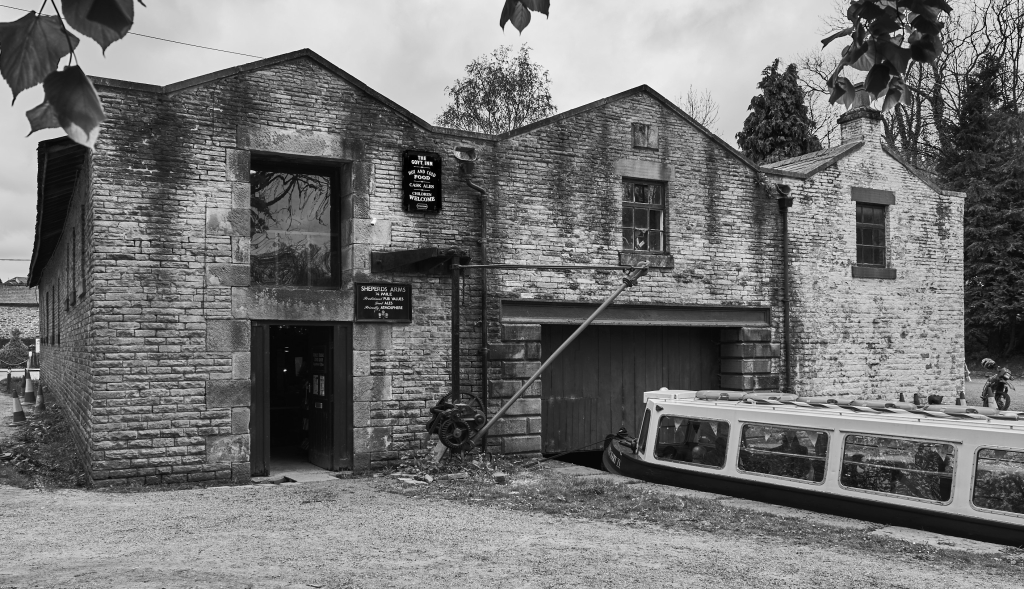
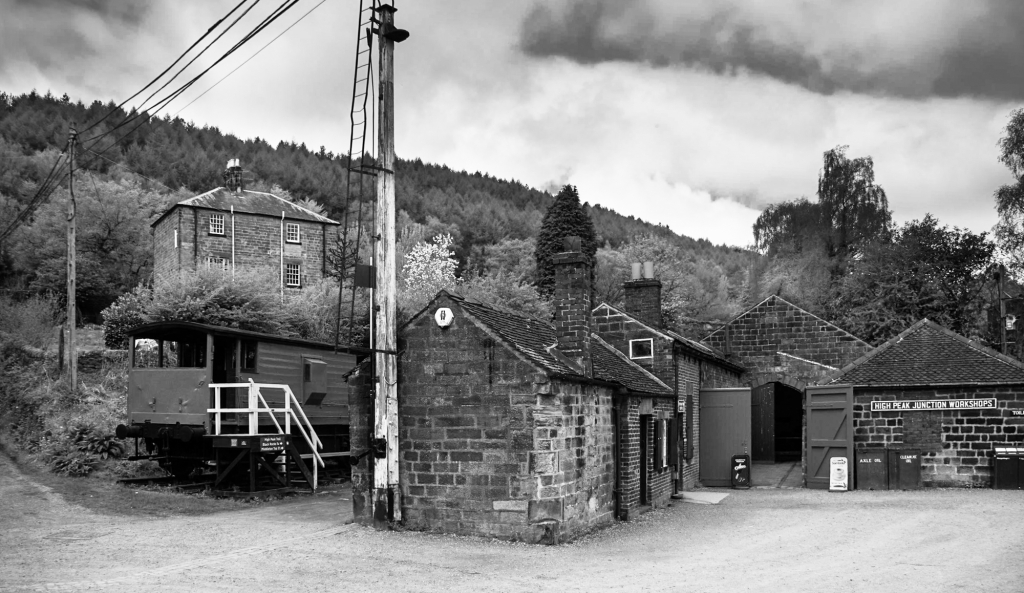
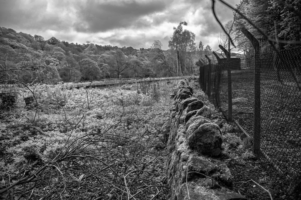
The yard at High Peak Junction on the Cromford Canal
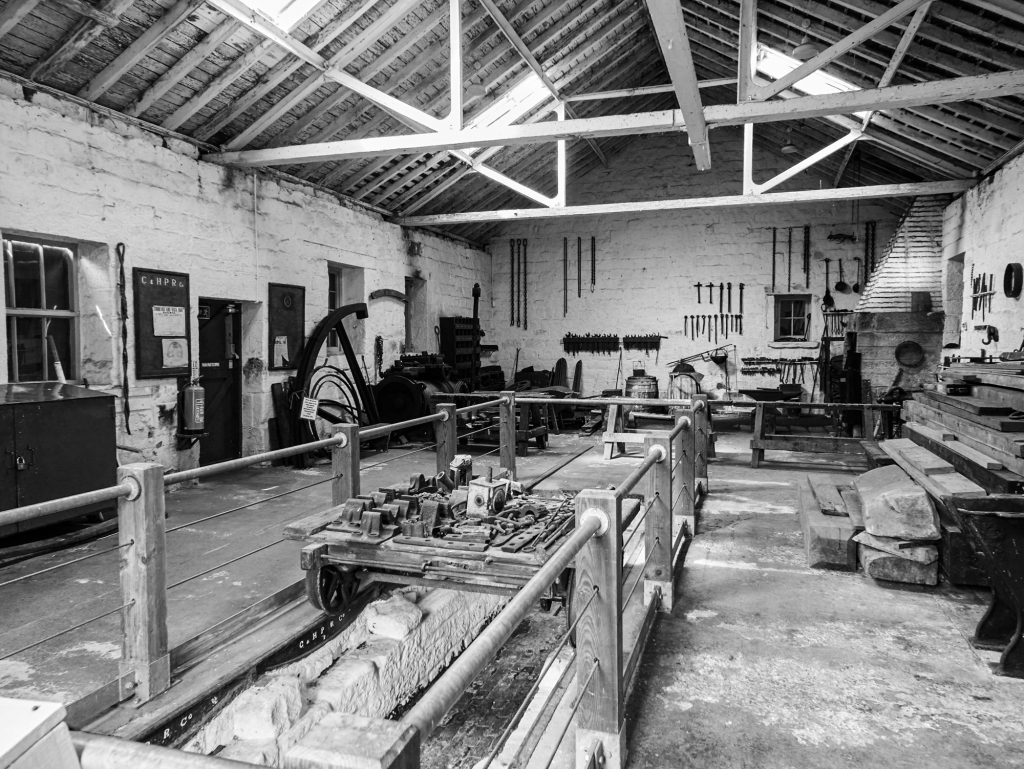
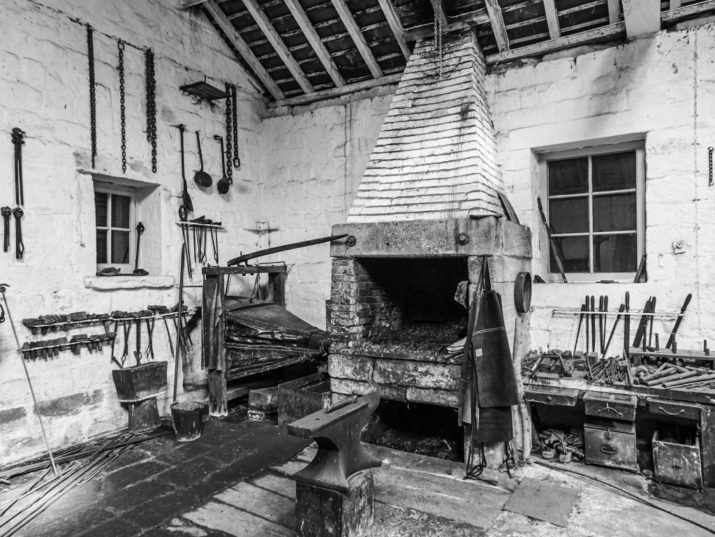
A6 bridge over the Sheep Pasture Incline and the catch pit. 1970-73.High Peak Junction workshops.High Peak Junction workshop.The transfer warehouse on the Cromford Canal.
The Connection the Main Line
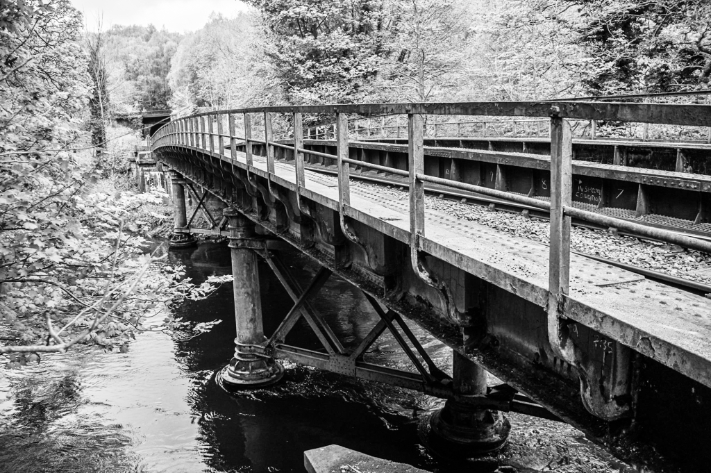
The extension to the junction with the Midland Railway.Cromford and High Peak Railway – High Peak Junction with the Midland line. The bridge (Midland line) across the Derwent.Cromford and High Peak Railway – High Peak Junction with the Midland line. The site of the junction.
Image Gallery
Click on any thumbnail to load higher resolution image.
Further reading
A Rimmer. The Cromford & High Peak Railway. The Oakwood Press 1985. ISBN 0 85361 319 2 John Marshall. The Cromford & High Peak Railway. Martin Bairstow 1996. ISBN 1 871944 14 7 A F Roberts and J T Leach. The Coal Mines of Buxton. Scarthin Books 2008. ISBN 978 0 90775 810 5 Colin E Mountford. Rope & Chain Haulage. Industrial Railway Society 2013. ISBN 1 901566 84 1
One of my earliest memories is of being taken around Hull docks on the crossbar of my father’s bike. I must have been less than five years old, because I got my first bicycle when I was five. There was essentially no security – the man on the gate was not bothered about a man and a child on a bicycle. When I was about seven years old we moved from Hull to Hedon, which was the main port on the Humber Estuary in the 12th and 13th centuries. The tiny river, Hedon Haven, was canalised around the town. The port fell out of use because ships became too large, and was replaced by Hull. The arm on the west side of the town, Fore Haven, was filled in but flooded to a depth of perhaps a foot during the winter, and we used to paddle around it in a tin horse trough. There was still a wharf on the Haven, with a derelict barge that we used to play on – which was of course strictly forbidden by our parents. This part of the Haven has now been filled in.
The derelict barge on Hedon Haven in about 1965.
I used to cycle to Goole and stay with an aunt when I was a teenager. I wandered around the docks with the Tom Puddings and coal hoists. The Tom Puddings were tub boats which linked to each other to form a long barge carrying coal down the River Aire to be loaded onto colliers in Goole docks. One of the coal hoists, which picked up the individual tubs and dumped the coal down a chute into the collier, is preserved.
The one remaining Coal Drop at the now-closed Waterways Museum, Goole.
The Regent’s Canal was a favourite place for walking when I was a student in London in the early 1960s. It was very scruffy, an industrial wasteland, unlike today.
Regent’s Canal near Camden Lock, around 1965.The same bridge in 2018.
I moved from London to the University of Lancaster. The Physics Department had been in existence for one year. We often walked along the Lancaster Canal, which gave easy access to the surrounding countryside. It was also very run down, but was still very pleasant to walk along as most of it was rural.
Lancaster Canal between 1966 and 1970.
The middle of the Peak District, where we have lived for more than fifty years, is not canal country. The nearest canals are the Peak Forest Canal to Bugsworth and Whaley Bridge, and the Cromford Canal. These were joined, over the top of the limestone plateau, by the Cromford & High Peak Railway. A canal was originally proposed as the link, and the C&HPR was built like a canal with flat stretches joined by steep inclines. Because of this history, I will include the C&HPR as an honorary canal.
The Peak Forest Canal runs through the middle of Marple, with a flight of 16 locks followed by the highest masonry aqueduct in England. The canal was built to provide an outlet for limestone quarries at Doveholes. The transhipment basin at Bugsworth was connected to the quarries by the Peak Forest Tramway. The first part of the tramway is now under the bypass, but it can be followed in separate stretches from the outskirts of Chapel-en-le-Frith to Barmoor Clough, and then into Dove Holes quarry. A short branch leads to the canal basin in Whaley Bridge, which was the transhipment point for the Cromford and High Peak Railway, which is another interesting story.
My walk began at the juction with the Macclesfield Canal at the top of the flight of locks. The total fall is 209 feet in one mile, and the deepest lock has a drop of about 16 feet.
Macclesfield Canal Bridge 1 at the junction with the Peak Forest Canal, with the top of the lock flight along to the right.
The top three locks have large side pounds. They are surrounded by houses, and a road runs immediately to the left of the canal with terraced houses facing the canal.
Lock 13 with Oldknow Road crossing the bridge just below the lock gates. Down the slope on the left is the horse tunnel under the road.
The horse tunnel beneath Oldknow Road, looking up the lock flight.
Samuel Oldknow’s warehouse between locks 9 and 10.
A work boat exiting lock 9, and about to pass under Station Road. Samuel Oldknow’s warehouse is in the background.
The single top gate of lock 6. All of the locks have a single gate at the top and a pair of mitre gates at the bottom. The top gates have inset paving blocks to push against when opening the gate.
The lower gates at lock 6, with lock 5 visible in the distance.
The bridge below the lower gates at lock 6. There are no inset paving blocks to push against at the lower gates, because the beams overhang the bridge and you walk across the bridge to push the gates open – very neat.
The paddle mechanism by the upper gate at lock 5.
The stonework is very well executed, and in good condition after 230 years wear.
The full extent of lock 4.
The lower gates of lock 4, renewed in 1997.
The cottage by lock 1. Below the lock, the canal passes under the railway and then over Marple Aqueduct.
Marple Aqueduct over the River Goyt, looking towards Rosehill Cutting.
The aqueduct with the later Marple Viaduct on the Hope Valley Line.
The aqueduct and viaduct from the level of the River Goyt.
Rosehill Cutting, an opened-out tunnel, just beyond the aqueduct.
The aqueduct from Rosehill Cutting.
A View from the Water
The Peak Forest Canal has two long levels separated by the Marple flight of locks. I have paddled a sea kayak from Bugsworth via Whaley Bridge to the top of the lock flight. Canals are not very exciting by kayak, and you do get a duck’s-eye view of the world. The biggest challenge on this stretch of canal is passing the accommodation bridges, which are lifting bridges at towpath level – you need to be able to do the kayak-equivalent of limbo dancing to pass underneath them.
However, you do get a view of the structures that you cannot get from the towpath – these are the duck’s-eye view of Bridge 1 on the Macclesfield Canal.
Macclesfield Canal Bridge 1 from the Peak Forest Canal.
Bridge 1 is a roving bridge – this is the ramp on the Macclesfield Canal side of the bridge. A roving bridge allows the towing horse to move from the towpath on one side of the canal to the opposite side without untying the rope.
Peak Forest Canal seen from the Macclesfield Canal.
Canals, from the Bridgewater Canal to the Manchester Ship Canal, created Manchester. They run through the city centre, hidden below street level, unnoticed as you walk around. The Bridgewater Canal was engineered by James Brindley and opened in 1761, starting the canal age in England. The Manchester Ship Canal, connecting Manchester with the River Mersey, was opened in 1894. Manchester became the third-busiest port in the UK, despite being 40 miles from the sea. The hub of the old canal network is at Castlefields, next to the remains of the Roman fort. Castlefields is a three-dimensional maze of canal basins and railway viaducts. I recently walked back from Castlefields to Piccadilly Station along the Rochdale Canal.
The canal is never very far from a busy road, but feels isolated between high walls and the back of buildings. There are stretches that I would not walk along after dark.
Castlefields.Castlefields.Castlefields.Castlefields.Castlefields.Castlefields.Castlefields.Rochdale Canal.Rochdale Canal.Rochdale Canal – the Deansgate Tunnel.Rochdale Canal – the Deansgate Tunnel.Rochdale Canal – the end of the Deansgate Tunnel.Rochdale Canal. The Deansgate-Castlefield metro station is on the viaduct to the left.Rochdale Canal. Albion Street bridge.Rochdale Canal. The Axis Tower.Rochdale Canal – the Bridgewater Basin and Bridgewater Hall are on the left past the locks.Rochdale Canal – the Bridgewater Basin junction and Oxford Street bridge.Rochdale Canal.Rochdale Canal, Manchester.Rochdale Canal – the tunnel beneath Piccadilly.Rochdale Canal – the tunnel beneath Piccadilly. This is very dark – I did not see the man at the end until I almost walked into him. Rochdale Canal – the end of the Piccadilly tunnel.Rochdale Canal. From here, at the end of the Piccadilly tunnel, I walked the short distance through back streets to the Ashton Canal, which joins the Rochdale Canal near the Store Street aqueduct.
Cornwall has a spectacular coastline – unless you happen to be in a small boat with an onshore wind, in which case it can be terrifying. Large stretches of it have the remains of Cornwall’s centuries of tin, copper and lead mining, and you can follow it by walking the South West Coastal Path. We walked from the Crowns section of the Botallack Mine to Pendeen Lighthouse on a day of brilliant sunshine and clouds – my ideal weather for photography. There was a force 6 wind, so the wind-chill temperature was just above zero. The Cornish mining landscapes are a UNESCO World Heritage Site.
Botallack Mine is the most spectacularly-situated of all of the coastal mines, with the engine houses perched just above the sea. The mine was being worked beneath the sea by 1778, and closed because of flooding in 1895. The output was copper, tin and arsenic. There are extensive remains on top of the cliff, including a handsome Count House.
A little over a kilometer further north is the Levant Mine. Pendeen Lighthouse can be seen in the distance, with the Coastguard cottages directly above the mine buildings.
Levant Mine with a large shaft covered by an iron grid in the right foreground. The chimneys in the middle distance are the arsenic flue on the left and the compressor engine on the right. Pendeen Lighthouse can be seen in the distance.
Levant Mine: the house containing the preserved winding engine on the left, and the remains of the pumping engine house on the right. The Levant Mine (copper, tin and arsenic) was the most successful mine in the district. The workings extended 1.6 km beneath the sea. The mine closed in 1932.
Levant Mine: the winding engine house on the left, and the pumping engine house on the right.
Levant Mine: arsenic flue chimney on the left and compressor house on the right.
Levant Mine: remains of the Count House with the compressor engine behind.
Levant Mine: pumping and winding engine house and headgear. The chimney of Botallack Mine can be seen on top of the cliff in the distance.
Incline and tunnel at the Levant Mine.
The stack at the end of the flue from the arsenic calciner. The black colouration at the top of the stack is from the arsenic fumes.
Remains of the arsenic calciner.
Three views of the arsenic ovens.
Looking south over Trewellard Zawn to the remains of the Levant Mine and the calciner.
The Avarack below Carn Rôs – moderate sea state, force 6 wind.
Pendeen Lighthouse. The hump in the foreground is The Enys – a tidal island.
Pendeen Lighthouse, completed in 1900. The Admiralty chart labels the light Fl(4) 15s 59m 16M, which means the light flashes 4 times every 15s, is 59m above mean sea level (the tower is 17 m high), and it is visible for 16 nautical miles. A nautical mile is 1 minute of latitude, and is now defined as equal to 1852m.
Image Gallery
Click on any thumbnail to open a higher resolution image.
I think I have always been interested in bridges. They combine utility and elegance better than any other structure. I plan journeys so that they visit interesting bridges on route. I have photographed hundreds – Viaduc de Garabit, the Storebaelt Bridge, Pontcysyllte, Runcorn Bridge, the Viaduc de Millau, Ingrande Bridge, Pont de Sully, the Seto-Ohashi Bridge, Connel Bridge, Boothferry Bridge, Newport Transporter Bridge, Glenfinnan Viaduct, the Briare Aqueduct, Ganter Bridge, Eki-Narin bridge in Kyrgystan, Kvalsundet Bridge, Tjeldsundbrua, the Atlanterhavsvegen …
Here are a few of my favourites.
The earliest bridges were probably trees that had fallen across streams, and many small footbridges are still essentially a pair of trees with a plank deck. Clapper bridges could be the first constructed bridges – a rock slab laid on piers, and impossible to date. This example is in Cwmorthin, and leads to the quarry barracks in the background. It probably dates from the 19th century.
The first modern bridge was the Ironbridge across the River Severn, built in 1779 at Coalbrookdale, where Abraham Darby established, in 1709, the first blast furnace to smelt iron with coke rather than charcoal.
Although it is built with cast iron, the bridge follows woodworking practice, with the parts joined with dovetails, mortice joints, and wedges. The development of cast iron bridges was rapid – the next one to be built used about half the weight of iron. The banks of the River Severn are unstable, which has caused structural problems throughout the life of the bridge. In the early 1970s a concrete inverted arch was cast in the river to stabilise the abutments, and a major restoration has recently repaired broken joints and returned the bridge to its original condition.
Thomas Telford built more than a thousand bridges in Britain. He developed standardised designs for cast iron bridges, which his contemporaries thought were outstandingly light and elegant. The most beautiful of these bridges were at Bonar Bridge and Craigellachie. Bonar Bridge had two masonry arches and a cast iron arch, and was destroyed when it was undermined by flood water. Craigellachie Bridge across the River Spey was built between 1812 and 1814, and has been by-passed by a modern concrete bridge, from which the photograph was taken.
Telford also rebuilt the London-Holyhead turnpike, which was the strategically important route from London to Dublin, with an extension along the coast to Chester. The road engineering through North Wales is very fine, and includes two major bridges. The smaller of the two, across the Afon Conwy at Conwy, looks very similar to when it was built. It is now a pedestrian bridge owned by the National Trust who, for some reason, only allow you to cross it in summer. The bridge behind is the tubular railway bridge built by Robert Stephenson and William Fairbairn, a precursor to the now-destroyed bridge over the Menai Strait.
Telford’s masterpiece is the Menai Bridge, by far the longest single span bridge when it was built. The Admiralty requirement was that the passage through the Menai Strait by a warship should be unobstructed – hence the single span and the height above the water. Stephenson’s railway bridge – now a combined rail and road bridge after the tubular bridge was destroyed by a fire – is off the right of the picture. The water in between is the notorious Swellies. The tide runs at about 8 knots, there are numerous islands, and the bottom is very rough. The result is an exciting stretch of water – very interesting in a sea kayak.
The original bridge had a deck which was insufficiently stiff, and was destroyed on one occasion and damaged frequently by high winds – the same problem resulted two centuries later in the famous destruction of the Tacoma Narrows Bridge. A major reconstruction of the bridge was undertaken in the early 1940s. The suspension chains were replaced and a new deck was built below the old deck so that traffic was not interrupted. The trusses shown below, which separate the footway and the roadway, act as deck stiffeners. There is an excellent article in the Journal of the Institution of Civil Engineers (Telford was the first President) describing the history and the reconstruction of the bridge (G A Maunsell. Menai Bridge Reconstruction. Volume 25 Issue 3, JANUARY 1946, pp. 165-193).
Brunel built many bridges, two of which are well-known. The first is the very elegant brick bridge over the Thames at Maidenhead, which has very low rise arches. The second is the Clifton Suspension Bridge in Bristol. Brunel designed the bridge, but it was not completed in his lifetime. It was finished as a memorial to him, using chains from the old Hungerford Bridge over the Thames, when it was replaced by the present railway bridge.
There are three outstanding bridges over the Firth of Forth, two of them shown here in this panorama (the shoreline is actually straight). The first was John Fowler and Benjamin Baker’s railway bridge, the first major steel bridge.
In the past, painting the bridge was a process which went on all the time. In the image above, the covered parts of the bridge are being painted with a modern two-part paint that should last 30 years.
The view from a train of the Forth Road Bridge, before the Queensferry Crossing was built.
After the destruction of the Tacoma Narrows Bridge by wind-induced oscillation of the deck, suspension bridge construction was dominated by the American practice of stiffening the deck with large trusses. The Forth Road Bridge was the first suspension bridge to be designed with an aerodynamic deck to achieve stability, which lead to the bridge having a very slim stiffening truss – just visible in this photograph.
Because of the increase in both traffic volume and weight, a third bridge, The Queensferry Crossing, was built. This was the longest three-tower cable-stayed bridge in the world, and also the longest with overlapping cables, which give a stiffer and more slender bridge.
Following the construction of the Forth Road Bridge, the Severn Bridge had the first deck designed as an aerofoil. The result is wonderfully elegant, a blade of light across the Severn Estuary. Like the Forth Road Bridge, the Severn Bridge has had to supplemented by a cable-stayed bridge further down the estuary.
This view beneath the Welsh pylon clearly shows the deck aerofoil.
The more recent Humber Bridge has an aerofoil deck, and was briefly the longest single span bridge in the world.
Bridges do not have to be big to be beautiful – this is the Kylesku Bridge in the north of Scotland, looking east to the Glendhu Forest. It is curved in plan, and is now listed Category A by Historic Environment Scotland.
Finally, three historic bridges in Berwick-upon-Tweed. The first is the Old Bridge, built between 1611 and 1624.
The Royal Tweed Bridge, seen from the Old Bridge, was built between 1925 and 1928 and was the largest concrete arch bridge in the country when it was built. In the background is Robert Stephenson’s Royal Border Bridge (1847-50) carrying the East Coast Main Line high above the River Tweed.
Further Reading
I highly recommend David P Billington’s discussion of the genesis of beauty in structures in his ‘Tower and Bridge: the New Art of Structural Engineering’.
Image Gallery
Click on the thumbnail to open a higher resolution image.
Raasay is a small island lying between Skye and the mainland. Unlike most of the Hebridean islands, it has beautiful woods of birch and rowan, festooned with lichens. The strikingly diverse geology is reflected in the vegetation. The proprietor, George Rainy, cleared the common people off their land, replacing them with more profitable sheep. The memory remains, as do the house ruins. Unusually, there are also remains of heavy industry – an ironstone mine worked for a few years during the First World War by German Prisoners of War, in defiance of international agreements. The scenery is peaceful and beautiful, witness to inhumanity and outrage.
Towards the north of Raasay, Calum’s Road – built by Calum MacLeod with shovel and wheelbarrow – leads from Brochel to Arnish. From Arnish, there are paths to Eilean Fladday’s tidal causeway and to the remote bothy by Caol Eilean Tigh. Walking south, at the top of a long hill, the view to Dun Caan opens up. Below Dun Caan is the fertile limestone grassland of Hallaig and Screapadal. The people were cleared from there onto the infertile gneiss in the foreground. In the far distance is Rubha na’ Leac, above which is the track to Hallaig and the monument to Sorley MacLean.
‘Between the Leac and Fearns the road is under mild moss’ (Sorley MacLean, Hallaig).
The track from North Fearns to Hallaig is wide and well-built until the cairn commemorating Sorley MacLean. It runs part-way up the hillside between the beach and limestone cliffs. Below the track are grass-covered walls, remains of dwellings and field walls.
Below the track from North Fearns to Hallaig is an enclosure with a handsome wall, the upper part one vertical stone thick. The sanctuary of Applecross is on the other side of the Inner Sound.
After Sorley MacLean’s cairn, the track becomes a footpath through a birch wood.
‘I will wait for the birch wood until it comes up by the cairn until the whole ridge from Beinn na Lice will be under its shade.’
After the birch wood, the fertile limestone grassland below Dun Caan can be seen, with the remains of Hallaig above the enclosure wall.
The enclosure wall at Hallaig was built using the stone from the houses, and the name of the wall-builder is remembered. Applecross is on the horizon.
Below Dun Caan is green fertile grassland on the limestone. The people were cleared from here to make way for sheep, which were more profitable than people. The remains of houses are scattered across the more level ground.
Some house remains at Hallaig still stand waist-high, others are only low mounds in the grassland. It seems beautiful in the sunshine, and peaceful, with Applecross visible across the Inner Sound, but ecologically this is a devastated landscape and the Highlands as a whole are a monument to destroyed communities.
Part way up the east side of Raasay is Brae, with obvious house remains like this, and other walls buried in the grass. A path through the birch wood leads to Inver on the Sound of Raasay. There is said to be a Norse burial below the tree.
Ironstone was mined in the south of the island during the First World War. The buildings of Mine 1 are about 100 m above sea level, at the head of an incline down to the pier. The compressor house and haulage house can be seen, with the Cuillin on Skye across the Sound of Raasay. The mine entrance is to the right of the buildings.
In the foreground is the concrete base for the compressor. The mine was mothballed when it closed soon after the war, and all the machinery was removed for scrap during the Second World War. The Skye Cuillin are visible in the distance.
The 8 km of tunnels in Mine 1 are accessed by this adit (a horizontal tunnel). A steel grill now closes the entrance to the dangerous and unventilated workings.
The mine was ventilated by a fan house on the hillside above the Mine 1 entrance, looking from a distance like an abandoned church. The grill on the left is across the shaft leading down at 45° into the mine. The curved walls minimise the resistance to airflow.
Above the pier was a crusher and the kilns. Coal for the kilns was hauled up the incline from the pier. The pier incline hauler house echoes the shapes of Glamaig and Beinn Dearg Mhor on Skye. Loch Sligachan is to the right of the building.
The five calcining kilns had concrete bases with circular steel kilns above them. Only the bases remain, used as shelters by sheep.
The interior of the concrete bases of the five calcining kilns.
The social and economic history of the Clearances and crofting is impressively told by James Hunter in ‘The Making of the Crofting Community’.
Angus and Patricia MacDonald provide a superb overview (literally) of the landscape in ‘The Hebrides, an Aerial View of a Cultural Landscape’.
The history of the mine, with many historic photos and maps, is covered in ‘The Raasay Iron Mine: Where Enemies Became Friends’ by Laurence and Pamela Draper.
Sorley MacLean’s poem ‘Hallaig’ is quoted in full in the MacDonalds’ book, and also found in his ‘Hallaig and Other Poems’. The relationship between the Highlander, the Gaelic language, and the land is explored by James Hunter in ‘On the Other Side of Sorrow: Nature and People in the Scottish Highlands’, which includes a penetrating discussion of ‘Hallaig’.
Image Gallery
Click on the thumbnail to open a higher resolution image.


")


 across the Derwent near the C&HPR junction")


 with Robert Stephenson’s Royal Border Bridge (1847-50) in the background.")


